Białystok night lights from space
Night Light of Białystok (Podlasie) from space (Poland) Src. Average luminocity for 10x10km area is 75.8598% and for 50x50km: 6.1094%.
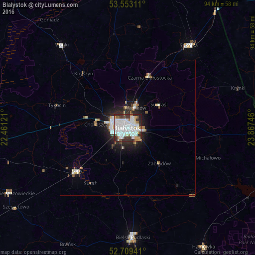
Analysis of Białystok night lights 2016
Square area 10x10 km:
 29.92%
90-99
26.01%80-89
3.41%70-79
6.06%60-69
4.67%50-59
2.02%40-49
4.17%30-39
14.02%20-29
9.34%10-19
0.38%0-9
0%Square area 50x50 km:
1.57%90-99
1.41%80-89
0.47%70-79
0.48%60-69
0.6%50-59
0.34%40-49
0.48%30-39
0.85%20-29
1.82%10-19
3.15%0-9
88.82%Clear (daylight) street map image can be seen on geolist.org.
Map coordinates:
53° 33' 11.2" North, 22° 27' 40.4" East
53° 7' 60" North, 23° 9' 51.6" East
52° 42' 33.9" North, 23° 52' 2.9" East
Some cities around Białystok sort by population:
• Bielsk Podlaski
41 km =25.5 mi,  177°
177°
• Sokółka
37.8 km =23.5 mi,  36°
36°
• Łapy
24.5 km =15.2 mi,  229°
229°
• Mońki
38.8 km =24.1 mi,  321°
321°
• Czarna Białostocka
20.6 km =12.8 mi,  22°
22°
• Wasilków
7.9 km =4.9 mi, 21°
• Grudki
33.9 km =21.1 mi,  97°
97°
• Choroszcz
11.8 km =7.3 mi,  275°
275°
776069 (p: 291,855)
Sources (retrieved 2019-11-25):
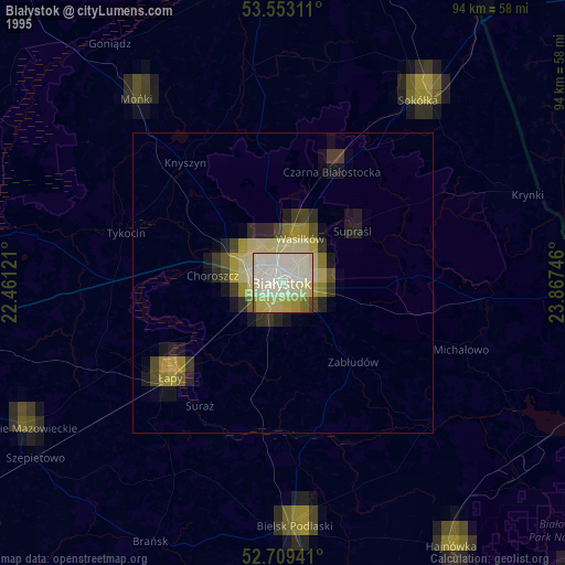
» NASA, Earths city lights 1995
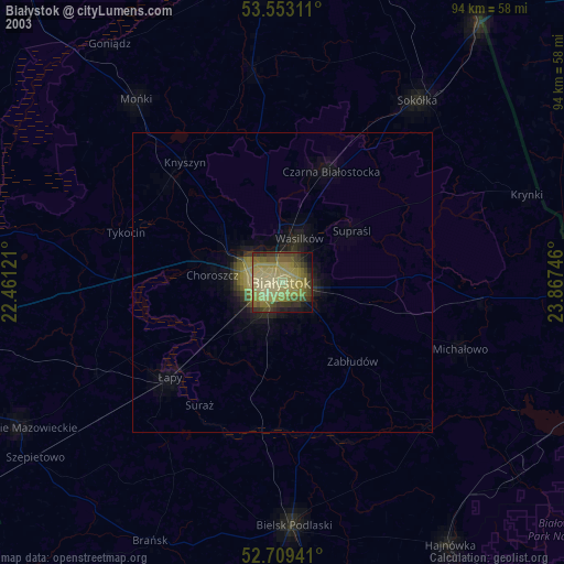
» NASA city lights 2003
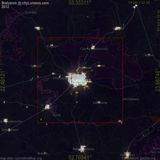
» Earth at Night: Flat Maps 2012, 2016