Nakło nad Notecią night lights from space
Night Light of Nakło nad Notecią (Kujawsko-Pomorskie) from space (Poland) Src. Average luminocity for 10x10km area is 11.3977% and for 50x50km: 3.2635%.
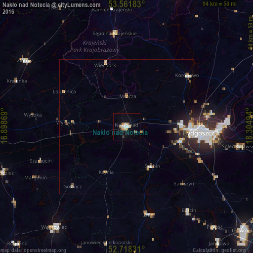
Analysis of Nakło nad Notecią night lights 2016
Square area 10x10 km:
 1.77%
1.77%90-99
1.77%80-89
1.39%70-79
1.77%60-69
1.39%50-59
1.01%40-49
1.01%30-39
0.51%20-29
0.51%10-19
2.78%0-9
86.11%Square area 50x50 km:
0.45%90-99
0.53%80-89
0.33%70-79
0.39%60-69
0.37%50-59
0.45%40-49
0.45%30-39
0.46%20-29
1.04%10-19
1.78%0-9
93.74%Clear (daylight) street map image can be seen on geolist.org.
Map coordinates:
53° 33' 42.6" North, 16° 53' 55.3" East
53° 8' 31.7" North, 17° 36' 6.5" East
52° 43' 5.9" North, 18° 18' 17.8" East
Some cities around Nakło nad Notecią sort by population:
• Bydgoszcz
27.2 km =16.9 mi,  94°
94°
• Żnin
33.5 km =20.8 mi,  166°
166°
• Koronowo
29.4 km =18.3 mi,  49°
49°
• Sępólno Krajeńskie
34.8 km =21.6 mi,  352°
352°
• Szubin
17.4 km =10.8 mi,  147°
147°
• Białe Błota
21.6 km =13.4 mi,  103°
103°
• Więcbork
24.7 km =15.3 mi,  342°
342°
• Wyrzysk
22.3 km =13.9 mi,  273°
273°
3091150 (p: 19,565)
Sources (retrieved 2019-11-25):
» Earth at Night: Flat Maps 2012, 2016