Białe Błota night lights from space
Night Light of Białe Błota (Kujawsko-Pomorskie) from space (Poland) Src. Average luminocity for 10x10km area is 35.5476% and for 50x50km: 7.7777%.
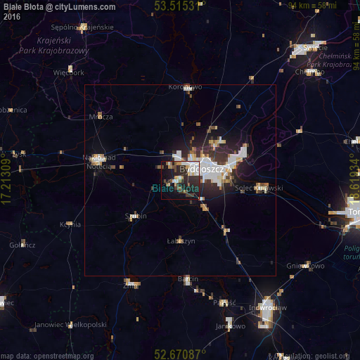
Analysis of Białe Błota night lights 2016
Square area 10x10 km:
 7.14%
7.14%90-99
7.14%80-89
2.65%70-79
3.17%60-69
2.38%50-59
3.57%40-49
4.63%30-39
7.28%20-29
18.25%10-19
22.22%0-9
21.56%Square area 50x50 km:
1.62%90-99
1.58%80-89
0.64%70-79
0.63%60-69
0.67%50-59
0.69%40-49
0.77%30-39
1.38%20-29
2.72%10-19
4.46%0-9
84.84%Clear (daylight) street map image can be seen on geolist.org.
Map coordinates:
53° 30' 55.1" North, 17° 12' 47.1" East
53° 5' 42.6" North, 17° 54' 58.4" East
52° 40' 15.1" North, 18° 37' 9.6" East
Some cities around Białe Błota sort by population:
• Bydgoszcz
6.9 km =4.3 mi,  62°
62°
• Fordon
18 km =11.2 mi,  70°
70°
• Nakło nad Notecią
21.6 km =13.4 mi,  283°
283°
• Solec Kujawski
20.7 km =12.9 mi,  93°
93°
• Żnin
30.3 km =18.8 mi,  205°
205°
• Koronowo
24.3 km =15.1 mi,  3°
3°
• Szubin
15.1 km =9.4 mi,  231°
231°
• Barcin
25.6 km =15.9 mi,  175°
175°
3103588 (p: 5,989)
Sources (retrieved 2019-11-25):
» Earth at Night: Flat Maps 2012, 2016