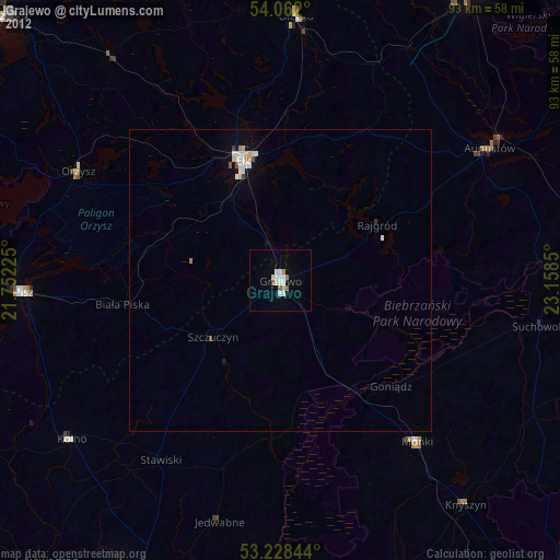
Grajewo night lights from space
Night Light of Grajewo (Podlasie) from space (Poland) Src. Average luminocity for 10x10km area is 13.5051% and for 50x50km: 1.6669%.
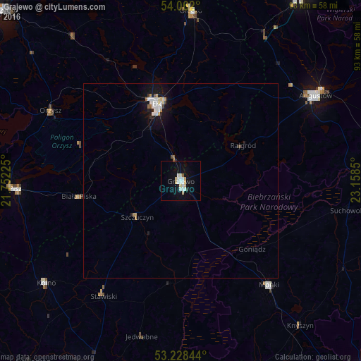
Analysis of Grajewo night lights 2016
Square area 10x10 km:
100  2.53%
2.53%
90-99 3.54%
80-89 2.78%
70-79 0.76%
60-69 0.25%
50-59 0.51%
40-49 0%
30-39 0.51%
20-29 0.38%
10-19 9.09%
0-9 79.67%
2.53%90-99
3.54%80-89
2.78%70-79
0.76%60-69
0.25%50-59
0.51%40-49
0%30-39
0.51%20-29
0.38%10-19
9.09%0-9
79.67%Square area 50x50 km:
100 0.35%
90-99 0.36%
80-89 0.21%
70-79 0.13%
60-69 0.09%
50-59 0.09%
40-49 0.08%
30-39 0.06%
20-29 0.18%
10-19 1.53%
0-9 96.93%
0.35%90-99
0.36%80-89
0.21%70-79
0.13%60-69
0.09%50-59
0.09%40-49
0.08%30-39
0.06%20-29
0.18%10-19
1.53%0-9
96.93%Clear (daylight) street map image can be seen on geolist.org.
Map coordinates:
54° 3' 43.2" North, 21° 45' 8.1" East
53° 38' 50.2" North, 22° 27' 19.3" East
53° 13' 42.4" North, 23° 9' 30.6" East
Some cities around Grajewo sort by population:
• Łomża
58.4 km =36.3 mi,  206°
206°
• Ełk
21 km =13 mi,  343°
343°
• Augustów
40.8 km =25.4 mi,  57°
57°
• Pisz
42.4 km =26.3 mi,  267°
267°
• Olecko
43.1 km =26.8 mi,  4°
4°
• Kolno
43.6 km =27.1 mi,  232°
232°
• Mońki
35.2 km =21.9 mi,  139°
139°
• Orzysz
37.9 km =23.5 mi,  298°
298°
771506 (p: 22,803)
Sources (retrieved 2019-11-25):
» Earth at Night: Flat Maps 2012, 2016