Krzyki night lights from space
Night Light of Krzyki (Lower Silesia) from space (Poland) Src. Average luminocity for 10x10km area is 85.5628% and for 50x50km: 15.8316%.
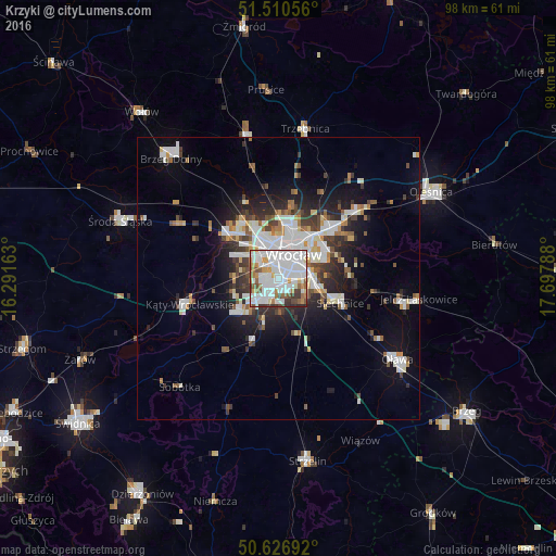
Analysis of Krzyki night lights 2016
Square area 10x10 km:
 38.77%
90-99
28.74%80-89
3.88%70-79
5.48%60-69
6.55%50-59
4.95%40-49
5.08%30-39
4.95%20-29
1.6%10-19
0%0-9
0%Square area 50x50 km:
4.03%90-99
3.74%80-89
1.08%70-79
1.23%60-69
1.36%50-59
1.57%40-49
1.74%30-39
2.13%20-29
3.65%10-19
7.41%0-9
72.06%Clear (daylight) street map image can be seen on geolist.org.
Map coordinates:
51° 30' 38" North, 16° 17' 29.9" East
51° 4' 15.1" North, 16° 59' 41.1" East
50° 37' 36.9" North, 17° 41' 52.4" East
Some cities around Krzyki sort by population:
• Wrocław
4.2 km =2.6 mi,  39°
39°
• Rejon ulicy Traugutta
5.1 km =3.2 mi,  46°
46°
• Powstańców Śląskich Zachód-Centrum Południow
3.2 km =2 mi,  29°
29°
• Powstańców Śląskich Wschód
3.1 km =1.9 mi, 42°
• Grabiszynek
1.9 km =1.2 mi,  341°
341°
• Rejon ulicy Mieleckiej
2.3 km =1.4 mi,  12°
12°
• Osiedle Henrykowskie
4.6 km =2.9 mi,  62°
62°
• Wojszyce
3.8 km =2.4 mi,  111°
111°
12047657 (p: 12,993)
Sources (retrieved 2019-11-25):
» Earth at Night: Flat Maps 2012, 2016