Karviná night lights from space
Night Light of Karviná (Moravskoslezský) from space (Czech Republic) Src. Average luminocity for 10x10km area is 28.8195% and for 50x50km: 20.9591%.
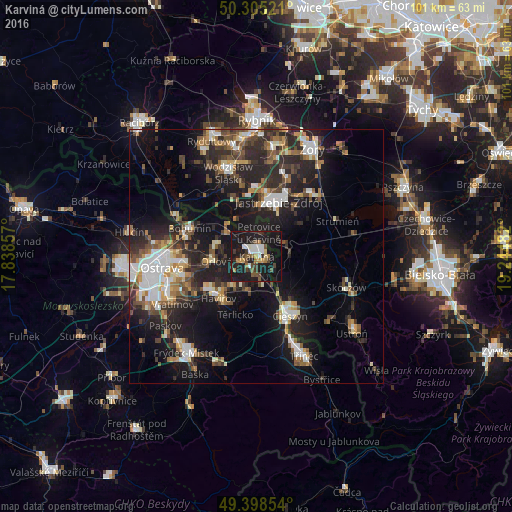
Analysis of Karviná night lights 2016
Square area 10x10 km:
 4.41%
4.41%90-99
3.07%80-89
1.2%70-79
2.67%60-69
3.74%50-59
4.14%40-49
4.81%30-39
4.68%20-29
7.09%10-19
52.54%0-9
11.63%Square area 50x50 km:
3.31%90-99
3.31%80-89
1.59%70-79
2.04%60-69
2.57%50-59
2.77%40-49
3.66%30-39
3.44%20-29
8.38%10-19
16.66%0-9
52.27%Clear (daylight) street map image can be seen on geolist.org.
Map coordinates:
50° 18' 18.8" North, 17° 50' 18.9" East
49° 51' 14.4" North, 18° 32' 30.1" East
49° 23' 54.7" North, 19° 14' 41.4" East
Some cities around Karviná sort by population:
• Jastrzębie Zdrój, PL
11.5 km =7.1 mi,  11°
11°
• Havířov
11.2 km =7 mi,  222°
222°
• Cieszyn, PL
13.1 km =8.1 mi,  150°
150°
• Orlová
8.1 km =5 mi,  263°
263°
• Český Těšín
13.4 km =8.3 mi, 153°
• Petřvald
11.2 km =7 mi, 256°
• Rychvald
11.9 km =7.4 mi,  276°
276°
• Zebrzydowice, PL
5.7 km =3.5 mi,  61°
61°
3073789 (p: 63,677)
Sources (retrieved 2019-11-25):
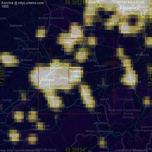
» NASA, Earths city lights 1995
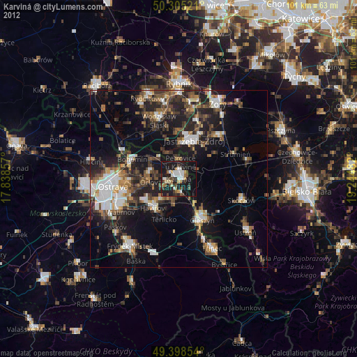
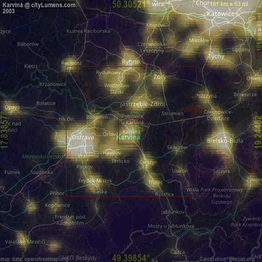
» NASA city lights 2003
» Earth at Night: Flat Maps 2012, 2016