Gryfice night lights from space
Night Light of Gryfice (West Pomerania) from space (Poland) Src. Average luminocity for 10x10km area is 5.0344% and for 50x50km: 0.8673%.
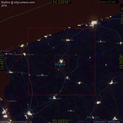
Analysis of Gryfice night lights 2016
Square area 10x10 km:
 0.4%
0.4%90-99
1.46%80-89
0.79%70-79
0%60-69
0.53%50-59
1.06%40-49
0.66%30-39
0.93%20-29
0%10-19
1.06%0-9
93.12%Square area 50x50 km:
0.07%90-99
0.09%80-89
0.08%70-79
0.14%60-69
0.2%50-59
0.18%40-49
0.12%30-39
0.08%20-29
0.12%10-19
0.16%0-9
98.73%Clear (daylight) street map image can be seen on geolist.org.
Map coordinates:
54° 19' 42.8" North, 14° 29' 49.7" East
53° 54' 59.4" North, 15° 12' 1" East
53° 30' 1.2" North, 15° 54' 12.2" East
Some cities around Gryfice sort by population:
• Kołobrzeg
38.2 km =23.7 mi,  40°
40°
• Nowogard
27.5 km =17.1 mi,  191°
191°
• Świdwin
41 km =25.5 mi,  112°
112°
• Wolin
39.3 km =24.4 mi,  257°
257°
• Łobez
41.4 km =25.7 mi,  138°
138°
• Trzebiatów
16.7 km =10.4 mi,  14°
14°
• Kamień Pomorski
28.6 km =17.8 mi,  281°
281°
• Karlino
46.2 km =28.7 mi,  73°
73°
3098201 (p: 16,720)
Sources (retrieved 2019-11-25):
» Earth at Night: Flat Maps 2012, 2016