Fordon night lights from space
Night Light of Fordon (Kujawsko-Pomorskie) from space (Poland) Src. Average luminocity for 10x10km area is 27.8788% and for 50x50km: 7.9047%.
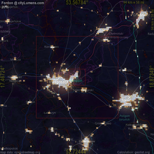
Analysis of Fordon night lights 2016
Square area 10x10 km:
 6.69%
6.69%90-99
7.95%80-89
2.53%70-79
1.52%60-69
1.14%50-59
1.39%40-49
1.52%30-39
1.14%20-29
11.62%10-19
23.99%0-9
40.53%Square area 50x50 km:
1.6%90-99
1.59%80-89
0.63%70-79
0.68%60-69
0.56%50-59
0.69%40-49
0.87%30-39
1.4%20-29
2.77%10-19
5.43%0-9
83.77%Clear (daylight) street map image can be seen on geolist.org.
Map coordinates:
53° 34' 4.2" North, 17° 28' 2.1" East
53° 8' 53.6" North, 18° 10' 13.3" East
52° 43' 28" North, 18° 52' 24.6" East
Some cities around Fordon sort by population:
• Bydgoszcz
11.2 km =7 mi,  255°
255°
• Toruń
32.2 km =20 mi,  117°
117°
• Chełmno
28 km =17.4 mi,  37°
37°
• Chełmża
29.2 km =18.1 mi,  82°
82°
• Solec Kujawski
8.1 km =5 mi,  152°
152°
• Koronowo
24.1 km =15 mi,  319°
319°
• Gniewkowo
32.4 km =20.1 mi, 150°
• Białe Błota
18 km =11.2 mi,  250°
250°
3099654 (p: 70,000)
Sources (retrieved 2019-11-25):
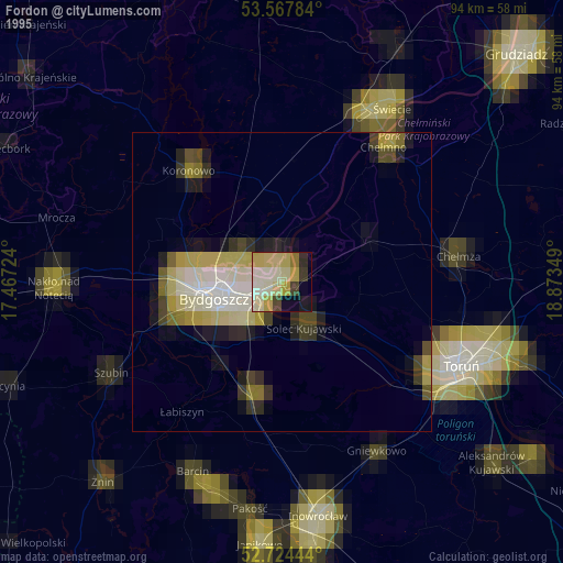
» NASA, Earths city lights 1995
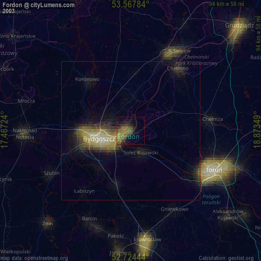
» NASA city lights 2003
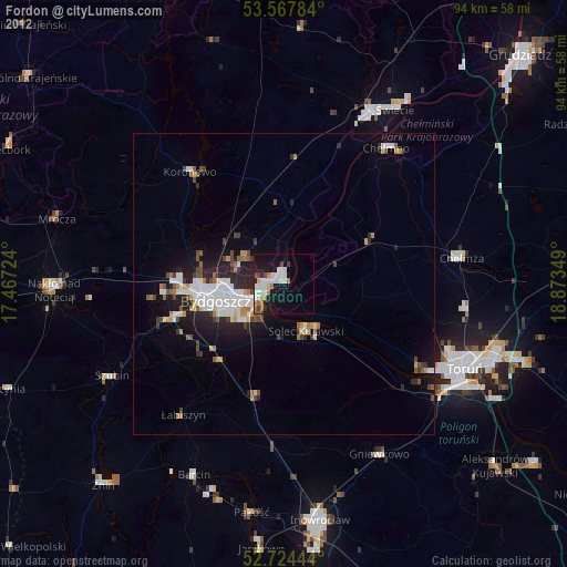
» Earth at Night: Flat Maps 2012, 2016