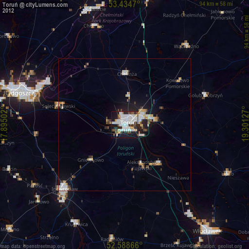
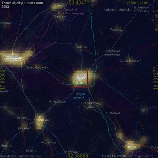
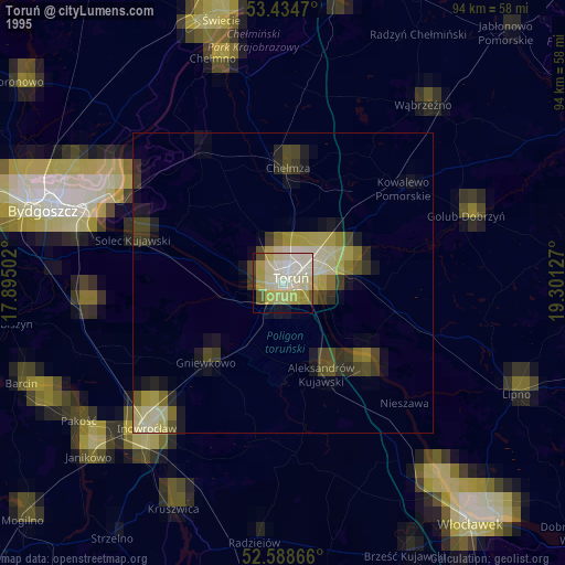
Toruń night lights from space
Night Light of Toruń (Kujawsko-Pomorskie) from space (Poland) Src. Average luminocity for 10x10km area is 61.9392% and for 50x50km: 7.3294%.
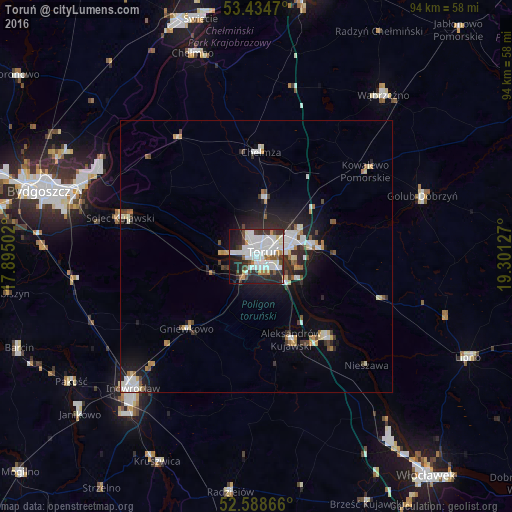
Analysis of Toruń night lights 2016
Square area 10x10 km:
 22.75%
90-99
20.24%80-89
0.66%70-79
5.03%60-69
3.31%50-59
2.65%40-49
6.22%30-39
8.33%20-29
16.4%10-19
13.23%0-9
1.19%Square area 50x50 km:
1.68%90-99
1.56%80-89
0.52%70-79
0.6%60-69
0.6%50-59
0.57%40-49
0.7%30-39
1.09%20-29
2.13%10-19
4.49%0-9
86.07%Clear (daylight) street map image can be seen on geolist.org.
Map coordinates:
53° 26' 4.9" North, 17° 53' 42.1" East
53° 0' 49.5" North, 18° 35' 53.3" East
52° 35' 19.2" North, 19° 18' 4.6" East
Some cities around Toruń sort by population:
• Inowrocław
32.8 km =20.4 mi,  223°
223°
• Fordon
32.2 km =20 mi,  297°
297°
• Chełmża
19 km =11.8 mi,  1°
1°
• Solec Kujawski
26.1 km =16.2 mi,  287°
287°
• Golub-Dobrzyń
32.3 km =20.1 mi,  70°
70°
• Aleksandrów Kujawski
16.5 km =10.3 mi,  157°
157°
• Ciechocinek
20 km =12.4 mi,  138°
138°
• Gniewkowo
18.4 km =11.4 mi, 223°
3083271 (p: 208,717)
Sources (retrieved 2019-11-25):
» NASA, Earths city lights 1995
» NASA city lights 2003
» Earth at Night: Flat Maps 2012, 2016