Dynów night lights from space
Night Light of Dynów (Subcarpathia) from space (Poland) Src. Average luminocity for 10x10km area is 0.2687% and for 50x50km: 2.5481%.
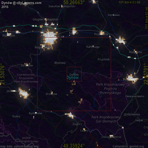
Analysis of Dynów night lights 2016
Square area 10x10 km:
 0%
0%90-99
0%80-89
0%70-79
0%60-69
0.27%50-59
0%40-49
0%30-39
0%20-29
0%10-19
0%0-9
99.73%Square area 50x50 km:
0.51%90-99
0.55%80-89
0.13%70-79
0.17%60-69
0.34%50-59
0.29%40-49
0.3%30-39
0.33%20-29
1.03%10-19
1.36%0-9
95%Clear (daylight) street map image can be seen on geolist.org.
Map coordinates:
50° 15' 59.9" North, 21° 31' 50.7" East
49° 48' 54.2" North, 22° 14' 2" East
49° 21' 33.3" North, 22° 56' 13.2" East
Some cities around Dynów sort by population:
• Rzeszów
30.3 km =18.8 mi,  326°
326°
• Sanok
28.9 km =18 mi,  184°
184°
• Łańcut
28.2 km =17.5 mi,  359°
359°
• Przeworsk
32.9 km =20.4 mi,  34°
34°
• Strzyżów
32.1 km =19.9 mi,  281°
281°
• Brzozów
20.4 km =12.7 mi,  229°
229°
• Korczyna
32.4 km =20.1 mi,  250°
250°
• Boguchwała
28 km =17.4 mi,  312°
312°
772772 (p: 6,065)
Sources (retrieved 2019-11-25):
» Earth at Night: Flat Maps 2012, 2016