Boguchwała night lights from space
Night Light of Boguchwała (Subcarpathia) from space (Poland) Src. Average luminocity for 10x10km area is 28.8543% and for 50x50km: 5.8298%.
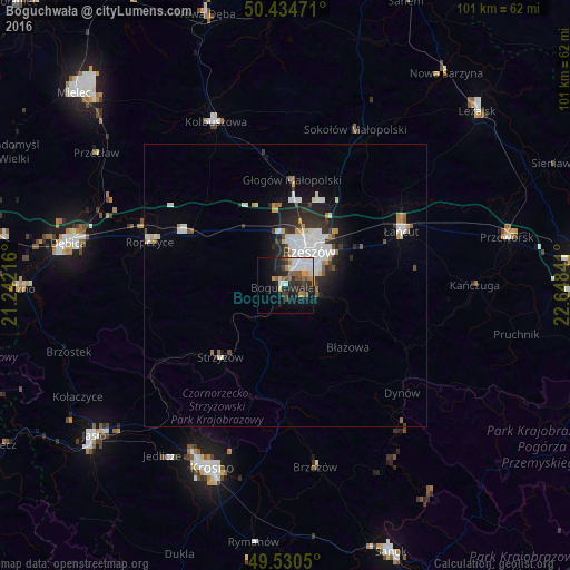
Analysis of Boguchwała night lights 2016
Square area 10x10 km:
 6.02%
6.02%90-99
5.46%80-89
2.1%70-79
2.66%60-69
4.62%50-59
2.66%40-49
4.06%30-39
2.8%20-29
12.04%10-19
15.83%0-9
41.74%Square area 50x50 km:
1.32%90-99
1.38%80-89
0.4%70-79
0.44%60-69
0.58%50-59
0.41%40-49
0.45%30-39
0.66%20-29
1.88%10-19
3.02%0-9
89.46%Clear (daylight) street map image can be seen on geolist.org.
Map coordinates:
50° 26' 5" North, 21° 14' 31.8" East
49° 59' 5" North, 21° 56' 43" East
49° 31' 49.8" North, 22° 38' 54.3" East
Some cities around Boguchwała sort by population:
• Rzeszów
7.4 km =4.6 mi,  31°
31°
• Łańcut
22.3 km =13.9 mi,  65°
65°
• Ropczyce
25.2 km =15.7 mi,  287°
287°
• Strzyżów
16.7 km =10.4 mi,  220°
220°
• Sędziszów Małopolski
19.9 km =12.4 mi,  298°
298°
• Rakszawa
28.7 km =17.8 mi,  47°
47°
• Dynów
28 km =17.4 mi,  132°
132°
• Głogów Małopolski
18.6 km =11.6 mi,  3°
3°
775717 (p: 5,823)
Sources (retrieved 2019-11-25):
» Earth at Night: Flat Maps 2012, 2016