Komorniki night lights from space
Night Light of Komorniki (Greater Poland) from space (Poland) Src. Average luminocity for 10x10km area is 52.447% and for 50x50km: 18.6862%.
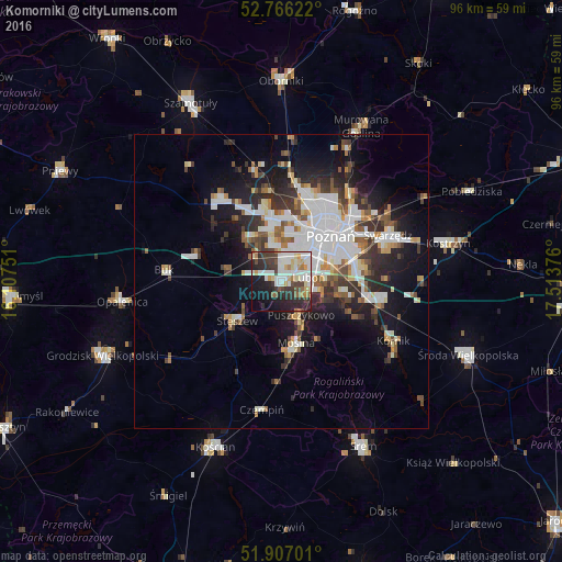
Analysis of Komorniki night lights 2016
Square area 10x10 km:
 12.12%
90-99
15.03%80-89
6.57%70-79
3.79%60-69
4.17%50-59
3.16%40-49
6.06%30-39
9.34%20-29
17.3%10-19
16.92%0-9
5.56%Square area 50x50 km:
4.57%90-99
4.19%80-89
1.48%70-79
1.5%60-69
1.63%50-59
2.16%40-49
1.95%30-39
3.17%20-29
4.5%10-19
9.29%0-9
65.57%Clear (daylight) street map image can be seen on geolist.org.
Map coordinates:
52° 45' 58.4" North, 16° 6' 27" East
52° 20' 19.3" North, 16° 48' 38.3" East
51° 54' 25.2" North, 17° 30' 49.5" East
Some cities around Komorniki sort by population:
• Poznań
11.1 km =6.9 mi,  46°
46°
• Luboń
5.6 km =3.5 mi,  80°
80°
• Mosina
10.7 km =6.6 mi,  166°
166°
• Puszczykowo
6.5 km =4 mi,  155°
155°
• Buk
19.9 km =12.4 mi,  275°
275°
• Plewiska
3.2 km =2 mi,  359°
359°
• Stęszew
9.6 km =6 mi,  230°
230°
• Czerwonak
18.2 km =11.3 mi,  39°
39°
3095396 (p: 5,144)
Sources (retrieved 2019-11-25):
» Earth at Night: Flat Maps 2012, 2016