Bochnia night lights from space
Night Light of Bochnia (Lesser Poland) from space (Poland) Src. Average luminocity for 10x10km area is 26.5546% and for 50x50km: 5.8516%.
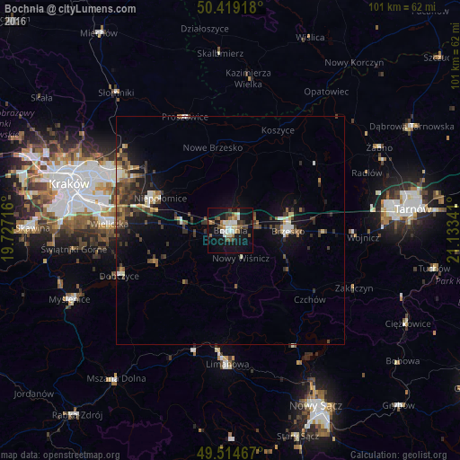
Analysis of Bochnia night lights 2016
Square area 10x10 km:
 5.04%
5.04%90-99
3.22%80-89
4.06%70-79
1.12%60-69
2.66%50-59
4.34%40-49
4.2%30-39
4.62%20-29
1.12%10-19
32.07%0-9
37.54%Square area 50x50 km:
0.5%90-99
0.72%80-89
0.65%70-79
0.3%60-69
0.81%50-59
1.02%40-49
1.28%30-39
1.64%20-29
1.16%10-19
4.77%0-9
87.16%Clear (daylight) street map image can be seen on geolist.org.
Map coordinates:
50° 25' 9" North, 19° 43' 37.8" East
49° 58' 8.6" North, 20° 25' 49" East
49° 30' 52.8" North, 21° 8' 0.3" East
Some cities around Bochnia sort by population:
• Kraków
36.7 km =22.8 mi,  286°
286°
• Wieliczka
26.2 km =16.3 mi,  274°
274°
• Brzesko
12.6 km =7.8 mi,  89°
89°
• Limanowa
29.3 km =18.2 mi,  181°
181°
• Niepołomice
16.8 km =10.4 mi,  298°
298°
• Dobczyce
26.3 km =16.3 mi,  248°
248°
• Proszowice
26.8 km =16.7 mi,  337°
337°
• Kazimierza Wielka
33.3 km =20.7 mi,  7°
7°
775758 (p: 29,184)
Sources (retrieved 2019-11-25):
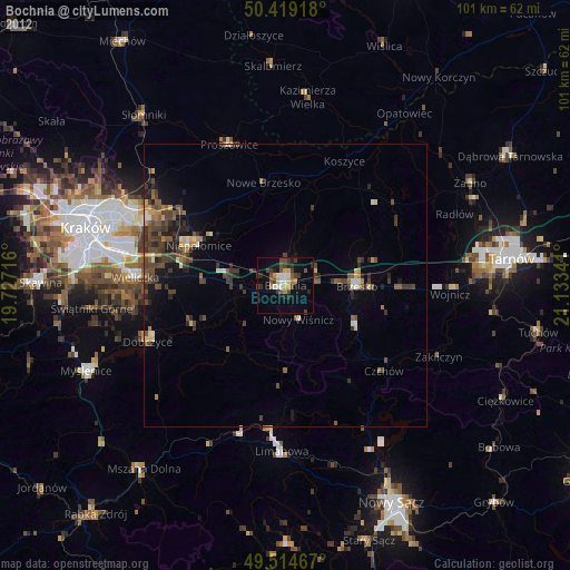
» Earth at Night: Flat Maps 2012, 2016