Brzesko night lights from space
Night Light of Brzesko (Lesser Poland) from space (Poland) Src. Average luminocity for 10x10km area is 22.0462% and for 50x50km: 4.7371%.
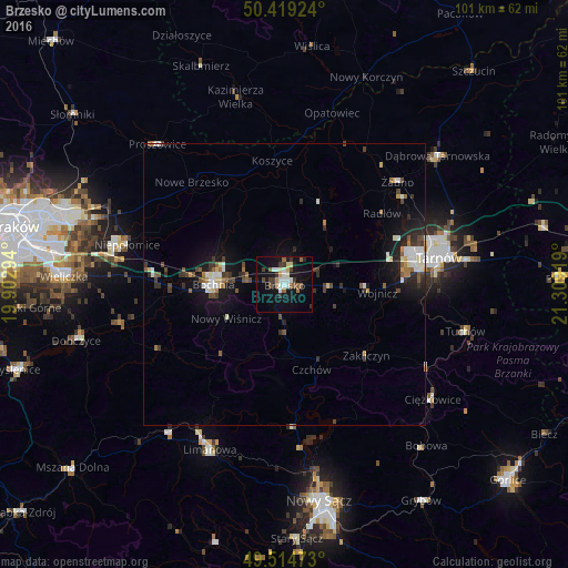
Analysis of Brzesko night lights 2016
Square area 10x10 km:
 3.36%
3.36%90-99
3.78%80-89
2.8%70-79
1.26%60-69
1.96%50-59
2.94%40-49
2.52%30-39
5.18%20-29
1.96%10-19
22.27%0-9
51.96%Square area 50x50 km:
0.67%90-99
0.81%80-89
0.44%70-79
0.27%60-69
0.48%50-59
0.6%40-49
0.72%30-39
0.9%20-29
0.94%10-19
3.87%0-9
90.31%Clear (daylight) street map image can be seen on geolist.org.
Map coordinates:
50° 25' 9.3" North, 19° 54' 10.6" East
49° 58' 8.8" North, 20° 36' 21.8" East
49° 30' 53" North, 21° 18' 33.1" East
Some cities around Brzesko sort by population:
• Tarnów
27.7 km =17.2 mi,  79°
79°
• Bochnia
12.6 km =7.8 mi,  269°
269°
• Limanowa
32.1 km =19.9 mi,  204°
204°
• Dąbrowa Tarnowska
35.5 km =22.1 mi,  49°
49°
• Niepołomice
28.5 km =17.7 mi,  286°
286°
• Tuchów
33.1 km =20.6 mi,  104°
104°
• Proszowice
33.6 km =20.9 mi,  317°
317°
• Kazimierza Wielka
33.9 km =21.1 mi,  346°
346°
775183 (p: 16,866)
Sources (retrieved 2019-11-25):
» Earth at Night: Flat Maps 2012, 2016