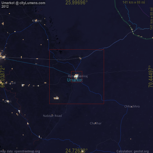
Umarkot night lights from space
Night Light of Umarkot (Sindh) from space (Pakistan) Src. Average luminocity for 10x10km area is 11.0992% and for 50x50km: 0.8611%.
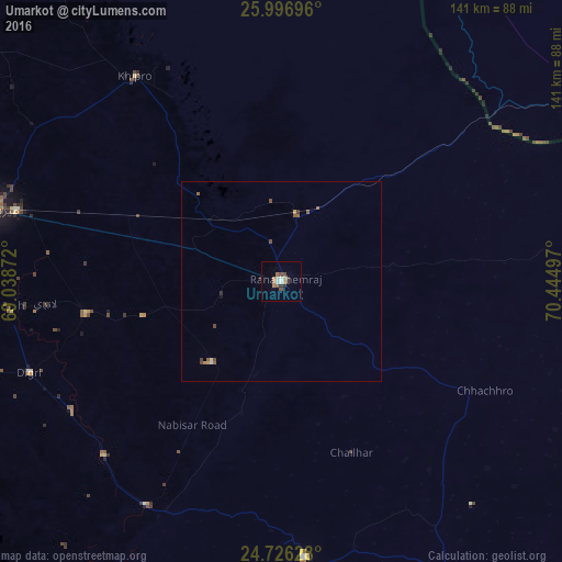
Analysis of Umarkot night lights 2016
Square area 10x10 km:
 0.79%
0.79%90-99
2.38%80-89
0.79%70-79
0.99%60-69
2.78%50-59
1.39%40-49
1.98%30-39
1.59%20-29
1.79%10-19
0.2%0-9
85.32%Square area 50x50 km:
0.03%90-99
0.12%80-89
0.06%70-79
0.1%60-69
0.16%50-59
0.26%40-49
0.25%30-39
0.12%20-29
0.1%10-19
0.04%0-9
98.75%Clear (daylight) street map image can be seen on geolist.org.
Map coordinates:
25° 59' 49.1" North, 69° 2' 19.4" East
25° 21' 47.8" North, 69° 44' 30.6" East
24° 43' 34.6" North, 70° 26' 41.9" East
Some cities around Umarkot sort by population:
• Digri
67.5 km =41.9 mi,  250°
250°
• Kunri
27.1 km =16.8 mi,  220°
220°
• Naukot
65.8 km =40.9 mi,  211°
211°
• Dhoro Naro
23.3 km =14.5 mi,  312°
312°
• Chhor
17.1 km =10.6 mi,  14°
14°
• Samaro
35.9 km =22.3 mi,  255°
255°
• Pithoro
40.1 km =24.9 mi,  294°
294°
• Nabisar
34.4 km =21.4 mi,  196°
196°
1162959 (p: 42,074)
Sources (retrieved 2019-11-25):
» Earth at Night: Flat Maps 2012, 2016