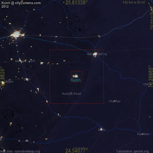
Kunri night lights from space
Night Light of Kunri (Sindh) from space (Pakistan) Src. Average luminocity for 10x10km area is 5.2659% and for 50x50km: 0.7669%.
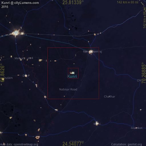
Analysis of Kunri night lights 2016
Square area 10x10 km:
 0%
0%90-99
0.79%80-89
0.79%70-79
0.79%60-69
0.79%50-59
1.59%40-49
1.98%30-39
0.4%20-29
0%10-19
0%0-9
92.86%Square area 50x50 km:
0.03%90-99
0.12%80-89
0.06%70-79
0.1%60-69
0.17%50-59
0.15%40-49
0.19%30-39
0.12%20-29
0.1%10-19
0.04%0-9
98.91%Clear (daylight) street map image can be seen on geolist.org.
Map coordinates:
25° 48' 48.2" North, 68° 51' 45.4" East
25° 10' 43.5" North, 69° 33' 56.6" East
24° 32' 26.8" North, 70° 16' 7.9" East
Some cities around Kunri sort by population:
• Umarkot
27.1 km =16.8 mi,  40°
40°
• Digri
45.8 km =28.5 mi,  266°
266°
• Naukot
39.3 km =24.4 mi,  204°
204°
• Dhoro Naro
36.3 km =22.6 mi,  0°
0°
• Chhor
43.1 km =26.8 mi,  30°
30°
• Samaro
20.5 km =12.7 mi,  303°
303°
• Pithoro
41.5 km =25.8 mi,  332°
332°
• Nabisar
14.7 km =9.1 mi,  147°
147°
1172657 (p: 26,773)
Sources (retrieved 2019-11-25):
» Earth at Night: Flat Maps 2012, 2016