Rustam night lights from space
Night Light of Rustam (Sindh) from space (Pakistan) Src. Average luminocity for 10x10km area is 0.4413% and for 50x50km: 3.7633%.
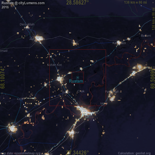
Analysis of Rustam night lights 2016
Square area 10x10 km:
 0%
0%90-99
0%80-89
0%70-79
0%60-69
0%50-59
0%40-49
0%30-39
0%20-29
0%10-19
0.57%0-9
99.43%Square area 50x50 km:
0.05%90-99
0.79%80-89
0.18%70-79
0.22%60-69
0.36%50-59
0.39%40-49
1.13%30-39
0.83%20-29
0.98%10-19
3.2%0-9
91.86%Clear (daylight) street map image can be seen on geolist.org.
Map coordinates:
28° 35' 10.6" North, 68° 6' 2.7" East
27° 58' 1.4" North, 68° 48' 13.9" East
27° 20' 39.3" North, 69° 30' 25.2" East
Some cities around Rustam sort by population:
• Sukkur
29.8 km =18.5 mi,  169°
169°
• Shikarpur
16.3 km =10.1 mi,  265°
265°
• Rohri
31.9 km =19.8 mi,  163°
163°
• Thul
30.5 km =19 mi,  354°
354°
• Garhiyasin
29.4 km =18.3 mi,  256°
256°
• Chak
12.4 km =7.7 mi, 166°
• Lakhi
16.7 km =10.4 mi,  217°
217°
• Bagarji
24.1 km =15 mi,  190°
190°
1166720 (p: 9,048)
Sources (retrieved 2019-11-25):
» Earth at Night: Flat Maps 2012, 2016