Chak night lights from space
Night Light of Chak (Sindh) from space (Pakistan) Src. Average luminocity for 10x10km area is 1.1364% and for 50x50km: 7.4937%.
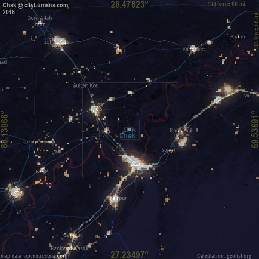
Analysis of Chak night lights 2016
Square area 10x10 km:
 0%
0%90-99
0%80-89
0%70-79
0%60-69
0%50-59
0.19%40-49
0.57%30-39
0.38%20-29
0.76%10-19
1.14%0-9
96.97%Square area 50x50 km:
0.58%90-99
2.2%80-89
0.42%70-79
0.45%60-69
0.58%50-59
0.77%40-49
1.56%30-39
1.05%20-29
2.53%10-19
5.79%0-9
84.08%Clear (daylight) street map image can be seen on geolist.org.
Map coordinates:
28° 28' 41.6" North, 68° 7' 50.4" East
27° 51' 30.2" North, 68° 50' 1.6" East
27° 14' 5.9" North, 69° 32' 12.9" East
Some cities around Chak sort by population:
• Sukkur
17.4 km =10.8 mi,  171°
171°
• Shikarpur
22 km =13.7 mi,  299°
299°
• Pano Aqil
27.3 km =17 mi,  90°
90°
• Rohri
19.5 km =12.1 mi,  161°
161°
• Garhiyasin
32.1 km =19.9 mi,  279°
279°
• Lakhi
13.2 km =8.2 mi,  265°
265°
• Rustam
12.4 km =7.7 mi,  346°
346°
• Bagarji
13.7 km =8.5 mi,  212°
212°
1181910 (p: 14,275)
Sources (retrieved 2019-11-25):
» Earth at Night: Flat Maps 2012, 2016