Sukkur night lights from space
Night Light of Sukkur (Sindh) from space (Pakistan) Src. Average luminocity for 10x10km area is 63.502% and for 50x50km: 8.8547%.
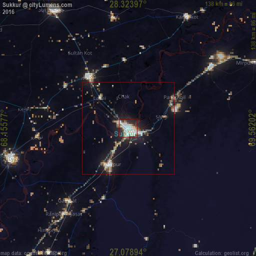
Analysis of Sukkur night lights 2016
Square area 10x10 km:
 13.49%
90-99
28.77%80-89
5.16%70-79
4.56%60-69
1.19%50-59
4.96%40-49
5.75%30-39
6.94%20-29
22.62%10-19
6.55%0-9
0%Square area 50x50 km:
0.82%90-99
2.05%80-89
0.57%70-79
0.61%60-69
0.79%50-59
1.17%40-49
1.89%30-39
1.27%20-29
2.8%10-19
7.84%0-9
80.18%Clear (daylight) street map image can be seen on geolist.org.
Map coordinates:
28° 19' 26.3" North, 68° 9' 20.8" East
27° 42' 11.6" North, 68° 51' 32" East
27° 4' 44.2" North, 69° 33' 43.3" East
Some cities around Sukkur sort by population:
• Khairpur Mir’s
21.7 km =13.5 mi,  206°
206°
• Pano Aqil
30.1 km =18.7 mi,  55°
55°
• Rohri
3.8 km =2.4 mi,  109°
109°
• Pir Jo Goth
26.7 km =16.6 mi,  242°
242°
• Chak
17.4 km =10.8 mi,  351°
351°
• Lakhi
22.5 km =14 mi,  315°
315°
• Rustam
29.8 km =18.5 mi, 349°
• Bagarji
11.4 km =7.1 mi,  299°
299°
1164408 (p: 417,767)
Sources (retrieved 2019-11-25):
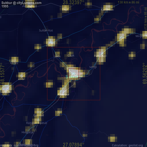
» NASA, Earths city lights 1995
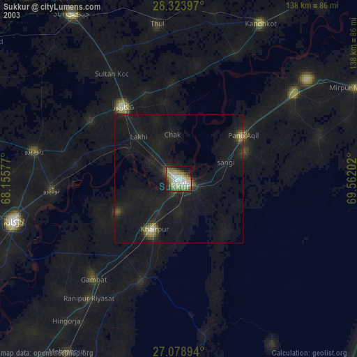
» NASA city lights 2003
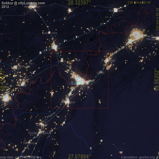
» Earth at Night: Flat Maps 2012, 2016