Garhiyasin night lights from space
Night Light of Garhiyasin (Sindh) from space (Pakistan) Src. Average luminocity for 10x10km area is 8.733% and for 50x50km: 4.4001%.
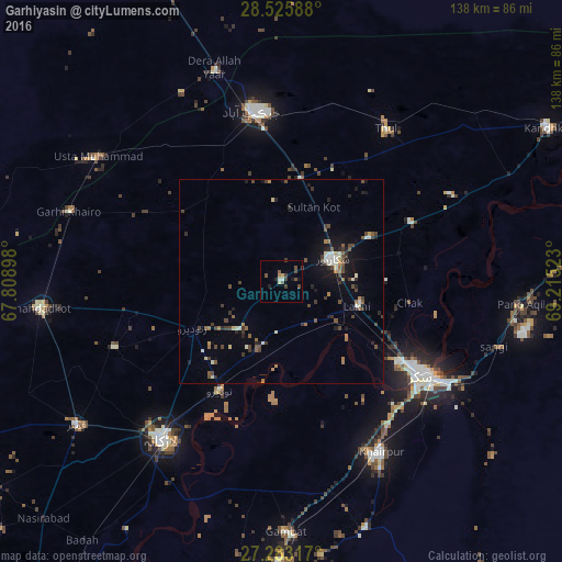
Analysis of Garhiyasin night lights 2016
Square area 10x10 km:
 0.38%
0.38%90-99
1.14%80-89
0.76%70-79
0.76%60-69
0.76%50-59
1.52%40-49
3.98%30-39
2.46%20-29
1.14%10-19
1.89%0-9
85.23%Square area 50x50 km:
0.05%90-99
0.85%80-89
0.27%70-79
0.29%60-69
0.53%50-59
0.61%40-49
1.37%30-39
1.04%20-29
0.84%10-19
2.43%0-9
91.71%Clear (daylight) street map image can be seen on geolist.org.
Map coordinates:
28° 31' 33.2" North, 67° 48' 32.3" East
27° 54' 22.7" North, 68° 30' 43.6" East
27° 16' 59.4" North, 69° 12' 54.8" East
Some cities around Garhiyasin sort by population:
• Shikarpur
13.5 km =8.4 mi,  66°
66°
• Ratodero
24.8 km =15.4 mi,  242°
242°
• Naudero
30.5 km =19 mi,  209°
209°
• Madeji
18 km =11.2 mi,  199°
199°
• Chak
32.1 km =19.9 mi,  99°
99°
• Lakhi
19.5 km =12.1 mi,  109°
109°
• Rustam
29.4 km =18.3 mi,  76°
76°
• Bagarji
29.6 km =18.4 mi,  124°
124°
1178843 (p: 14,810)
Sources (retrieved 2019-11-25):
» Earth at Night: Flat Maps 2012, 2016