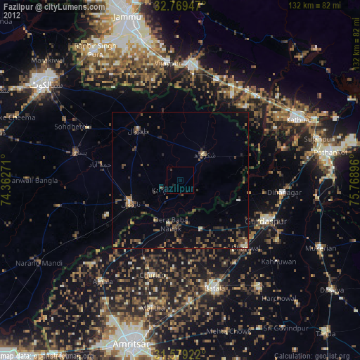
Fazilpur night lights from space
Night Light of Fazilpur (Punjab) from space (Pakistan) Src. Average luminocity for 10x10km area is 0.1573% and for 50x50km: 3.2184%.
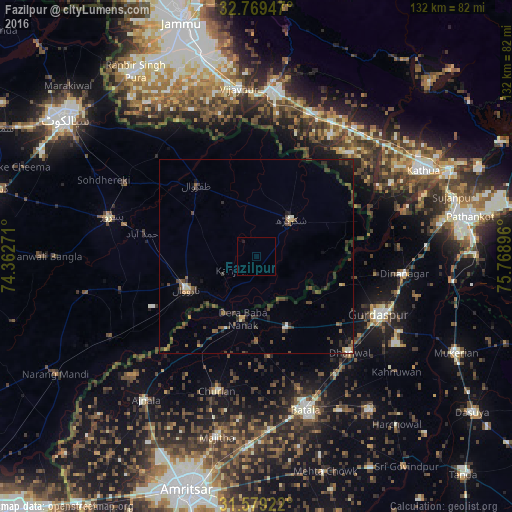
Analysis of Fazilpur night lights 2016
Square area 10x10 km:
 0%
0%90-99
0%80-89
0%70-79
0%60-69
0%50-59
0%40-49
0%30-39
0%20-29
0.35%10-19
0.35%0-9
99.3%Square area 50x50 km:
0.05%90-99
0.33%80-89
0.12%70-79
0.2%60-69
0.27%50-59
0.68%40-49
0.99%30-39
1.27%20-29
1.16%10-19
1.44%0-9
93.5%Clear (daylight) street map image can be seen on geolist.org.
Map coordinates:
32° 46' 10.1" North, 74° 21' 45.8" East
32° 10' 34.6" North, 75° 3' 57" East
31° 34' 45.2" North, 75° 46' 8.3" East
Some cities around Fazilpur sort by population:
• Narowal
19.9 km =12.4 mi,  245°
245°
• Shakargarh
13.1 km =8.1 mi,  42°
42°
• Zafarwal
24.4 km =15.2 mi,  320°
320°
• Dhāriwāl, IN
34.5 km =21.4 mi,  135°
135°
• Fatehgarh Chūriān, IN
36.2 km =22.5 mi,  196°
196°
• Kalanaur, IN
19.9 km =12.4 mi,  156°
156°
• Derā Nānak, IN
15.9 km =9.9 mi,  193°
193°
• Rām Dās, IN
27.5 km =17.1 mi,  212°
212°
1179255 (p: 28,213)
Sources (retrieved 2019-11-25):
» Earth at Night: Flat Maps 2012, 2016