Mian Channun night lights from space
Night Light of Mian Channun (Punjab) from space (Pakistan) Src. Average luminocity for 10x10km area is 17.9652% and for 50x50km: 3.0768%.
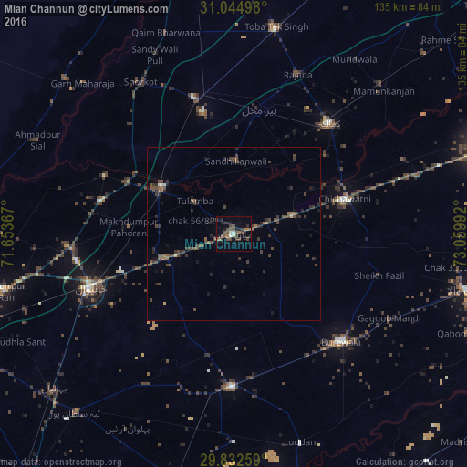

Analysis of Mian Channun night lights 2016
Square area 10x10 km:
 0.37%
0.37%90-99
1.83%80-89
0.73%70-79
0.18%60-69
2.75%50-59
4.58%40-49
8.61%30-39
5.13%20-29
3.3%10-19
7.51%0-9
65.02%Square area 50x50 km:
0.05%90-99
0.13%80-89
0.09%70-79
0.05%60-69
0.31%50-59
0.73%40-49
1.59%30-39
1.21%20-29
1.2%10-19
1.02%0-9
93.62%Clear (daylight) street map image can be seen on geolist.org.
Map coordinates:
31° 2' 41.9" North, 71° 39' 13.2" East
30° 26' 26.4" North, 72° 21' 24.4" East
29° 49' 57.3" North, 73° 3' 35.7" East
Some cities around Mian Channun sort by population:
• Būrewāla
41.5 km =25.8 mi,  137°
137°
• Vihari
44.1 km =27.4 mi,  180°
180°
• Kamalia
42.2 km =26.2 mi,  41°
41°
• Chichawatni
33.6 km =20.9 mi,  72°
72°
• Chak Thirty-one -Eleven Left
32.7 km =20.3 mi,  93°
93°
• Pir Mahal
37 km =23 mi,  11°
11°
• Talamba
14.7 km =9.1 mi,  310°
310°
• Sarai Sidhu
40.8 km =25.4 mi,  294°
294°
1170486 (p: 76,226)
Sources (retrieved 2019-11-25):
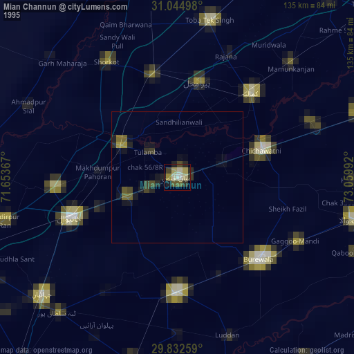
» NASA, Earths city lights 1995
» NASA city lights 2003
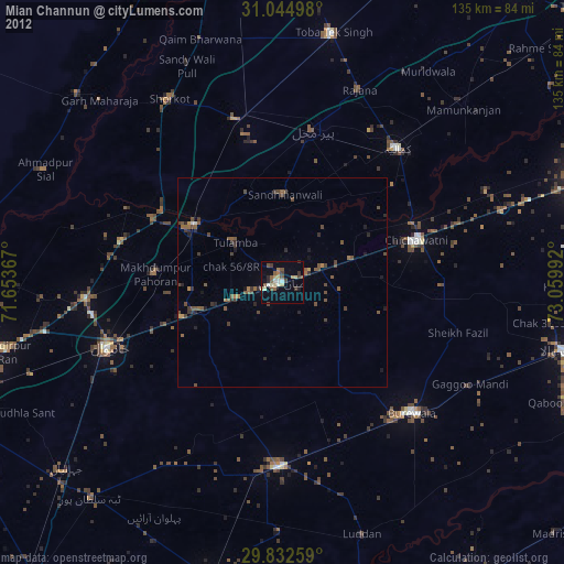
» Earth at Night: Flat Maps 2012, 2016