Khuzdar night lights from space
Night Light of Khuzdar (Balochistan) from space (Pakistan) Src. Average luminocity for 10x10km area is 2.4782% and for 50x50km: 0.5233%.
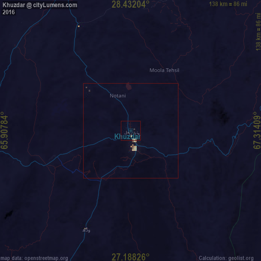


Analysis of Khuzdar night lights 2016
Square area 10x10 km:
 0%
0%90-99
0%80-89
0.4%70-79
0%60-69
0%50-59
1.39%40-49
0.2%30-39
0.4%20-29
1.19%10-19
0.79%0-9
95.63%Square area 50x50 km:
0%90-99
0%80-89
0.2%70-79
0.08%60-69
0.05%50-59
0.12%40-49
0.05%30-39
0.06%20-29
0.1%10-19
0.03%0-9
99.31%Clear (daylight) street map image can be seen on geolist.org.
Map coordinates:
28° 25' 55.3" North, 65° 54' 28.2" East
27° 48' 42.9" North, 66° 36' 39.5" East
27° 11' 17.7" North, 67° 18' 50.7" East
Some cities around Khuzdar sort by population:
• Shahdad Kot
127.5 km =79.2 mi,  88°
88°
• Mehar
138.4 km =86 mi,  120°
120°
• Khairpur Nathan Shah
136.9 km =85.1 mi,  125°
125°
• Nasirabad
137.3 km =85.3 mi,  110°
110°
• Kalat
135.1 km =83.9 mi,  359°
359°
• Warah
123.6 km =76.8 mi, 109°
• Garhi Khairo
137.3 km =85.3 mi,  78°
78°
• Surab
83.2 km =51.7 mi,  335°
335°
1173664 (p: 141,227)
Sources (retrieved 2019-11-25):
» NASA, Earths city lights 1995
» NASA city lights 2003
» Earth at Night: Flat Maps 2012, 2016