Kharian night lights from space
Night Light of Kharian (Punjab) from space (Pakistan) Src. Average luminocity for 10x10km area is 28.1521% and for 50x50km: 6.271%.
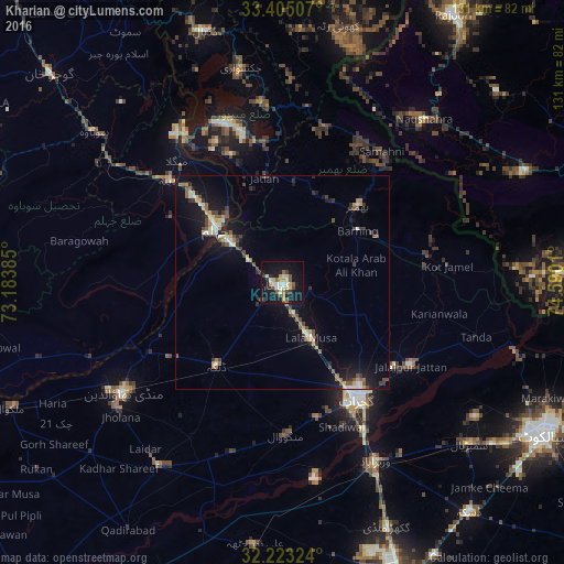
Analysis of Kharian night lights 2016
Square area 10x10 km:
 0.7%
0.7%90-99
7.69%80-89
3.85%70-79
3.85%60-69
1.92%50-59
6.12%40-49
1.92%30-39
2.27%20-29
3.85%10-19
37.41%0-9
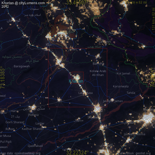
30.42%Square area 50x50 km:
0.12%90-99
1.16%80-89
0.69%70-79
0.74%60-69
0.75%50-59
0.99%40-49
1.05%30-39
0.9%20-29
1.11%10-19
6.26%0-9
86.23%Clear (daylight) street map image can be seen on geolist.org.
Map coordinates:
33° 24' 18.3" North, 73° 11' 1.9" East
32° 48' 58" North, 73° 53' 13.1" East
32° 13' 23.7" North, 74° 35' 24.4" East
Some cities around Kharian sort by population:
• Bhimbar
25.1 km =15.6 mi,  45°
45°
• Gujrat
32.2 km =20 mi,  146°
146°
• Jhelum
19.6 km =12.2 mi,  312°
312°
• Jalalpur Jattan
35.6 km =22.1 mi,  123°
123°
• Lala Musa
14.4 km =8.9 mi, 152°
• Sarai Alamgir
15.8 km =9.8 mi, 308°
• Dinga
24.9 km =15.5 mi,  218°
218°
• Kunjah
32.9 km =20.4 mi,  165°
165°
1174042 (p: 81,435)
Sources (retrieved 2019-11-25):
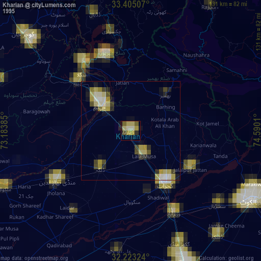
» NASA, Earths city lights 1995
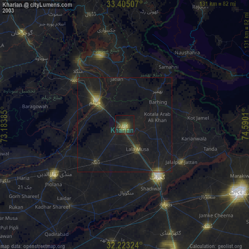
» NASA city lights 2003
» Earth at Night: Flat Maps 2012, 2016