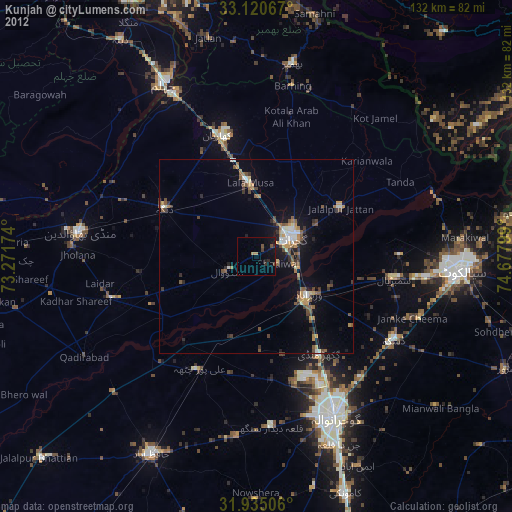
Kunjah night lights from space
Night Light of Kunjah (Punjab) from space (Pakistan) Src. Average luminocity for 10x10km area is 6.1795% and for 50x50km: 6.3367%.
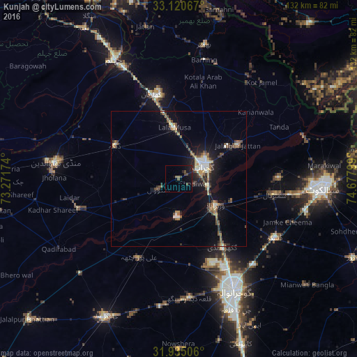
Analysis of Kunjah night lights 2016
Square area 10x10 km:
 0%
0%90-99
0%80-89
0%70-79
0%60-69
0.92%50-59
1.47%40-49
3.48%30-39
0%20-29
1.28%10-19
11.17%0-9
81.68%Square area 50x50 km:
0.22%90-99
1.21%80-89
0.57%70-79
0.66%60-69
0.87%50-59
1.01%40-49
1.51%30-39
0.77%20-29
1.38%10-19
4.7%0-9
87.1%Clear (daylight) street map image can be seen on geolist.org.
Map coordinates:
33° 7' 14.4" North, 73° 16' 18.3" East
32° 31' 47.4" North, 73° 58' 29.5" East
31° 56' 6.2" North, 74° 40' 40.8" East
Some cities around Kunjah sort by population:
• Gujrat
10.6 km =6.6 mi,  62°
62°
• Wazirabad
16.7 km =10.4 mi,  125°
125°
• Jalalpur Jattan
24.9 km =15.5 mi, 60°
• Lala Musa
19.1 km =11.9 mi,  355°
355°
• Dinga
26.9 km =16.7 mi,  297°
297°
• Sodhri
20.8 km =12.9 mi,  111°
111°
• Rasulnagar
28.9 km =18 mi,  219°
219°
• Dhaunkal
20.5 km =12.7 mi, 132°
1172663 (p: 28,103)
Sources (retrieved 2019-11-25):
» Earth at Night: Flat Maps 2012, 2016