Gujrat night lights from space
Night Light of Gujrat (Punjab) from space (Pakistan) Src. Average luminocity for 10x10km area is 49.8846% and for 50x50km: 6.5488%.
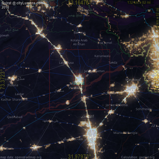
Analysis of Gujrat night lights 2016
Square area 10x10 km:
 2.97%
2.97%90-99
18.53%80-89
7.34%70-79
6.82%60-69
5.07%50-59
6.29%40-49
4.37%30-39
4.55%20-29
15.03%10-19
28.32%0-9
0.7%Square area 50x50 km:
0.22%90-99
1.24%80-89
0.56%70-79
0.63%60-69
0.84%50-59
1.01%40-49
1.51%30-39
0.91%20-29
1.48%10-19
5.44%0-9
86.15%Clear (daylight) street map image can be seen on geolist.org.
Map coordinates:
33° 9' 53.1" North, 73° 22' 20.3" East
32° 34' 27.1" North, 74° 4' 31.5" East
31° 58' 47" North, 74° 46' 42.8" East
Some cities around Gujrat sort by population:
• Wazirabad
15.1 km =9.4 mi,  163°
163°
• Jalalpur Jattan
14.3 km =8.9 mi,  58°
58°
• Lala Musa
17.9 km =11.1 mi,  322°
322°
• Sambrial
28.2 km =17.5 mi,  112°
112°
• Kunjah
10.6 km =6.6 mi,  242°
242°
• Sodhri
16 km =9.9 mi,  141°
141°
• Dhaunkal
19.6 km =12.2 mi, 162°
• Begowala
23.6 km =14.7 mi,  129°
129°
1177654 (p: 301,506)
Sources (retrieved 2019-11-25):
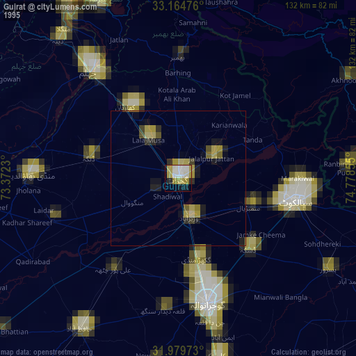
» NASA, Earths city lights 1995
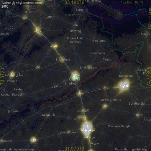
» NASA city lights 2003
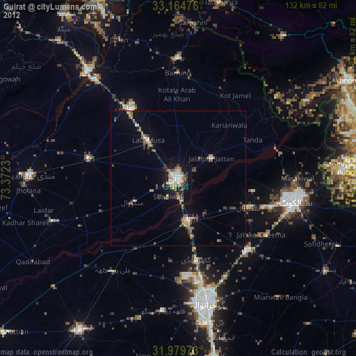
» Earth at Night: Flat Maps 2012, 2016