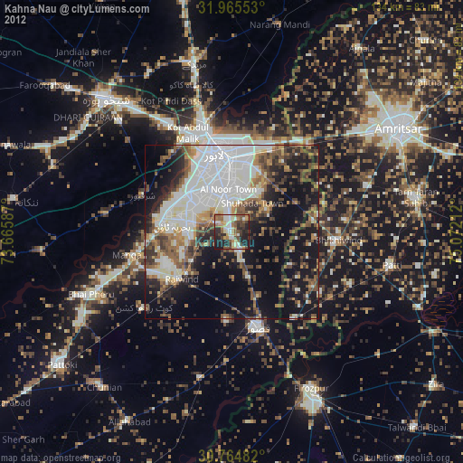
Kahna Nau night lights from space
Night Light of Kahna Nau (Punjab) from space (Pakistan) Src. Average luminocity for 10x10km area is 59.5944% and for 50x50km: 47.5367%.
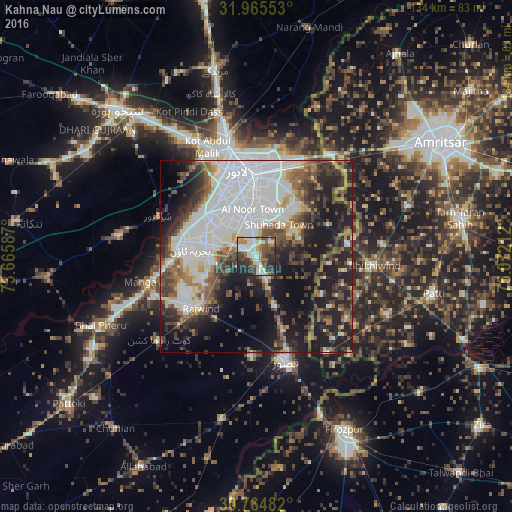
Analysis of Kahna Nau night lights 2016
Square area 10x10 km:
 6.47%
6.47%90-99
22.9%80-89
2.62%70-79
4.55%60-69
11.89%50-59
7.17%40-49
12.24%30-39
11.89%20-29
16.78%10-19
3.5%0-9
0%Square area 50x50 km:
12.67%90-99
13.09%80-89
2.41%70-79
3.01%60-69
4.95%50-59
6%40-49
7.36%30-39
7.14%20-29
10.46%10-19
18.86%0-9
14.06%Clear (daylight) street map image can be seen on geolist.org.
Map coordinates:
31° 57' 55.9" North, 73° 39' 57.1" East
31° 22' 1.5" North, 74° 22' 8.4" East
30° 45' 53.4" North, 75° 4' 19.6" East
Some cities around Kahna Nau sort by population:
• Lahore
21.3 km =13.2 mi,  355°
355°
• Kasur
28.7 km =17.8 mi,  164°
164°
• Mianke Mor
43.9 km =27.3 mi,  245°
245°
• Kot Radha Kishan
33.5 km =20.8 mi,  229°
229°
• Sharqpur Sharif
27.5 km =17.1 mi,  292°
292°
• Raiwind
19.6 km =12.2 mi, 228°
• Raja Jang
19.6 km =12.2 mi,  213°
213°
• Khem Karan, IN
30.7 km =19.1 mi,  143°
143°
1175453 (p: 45,888)
Sources (retrieved 2019-11-25):
» Earth at Night: Flat Maps 2012, 2016