Ferozepore night lights from space
Night Light of Ferozepore (Punjab) from space (India) Src. Average luminocity for 10x10km area is 59.0507% and for 50x50km: 14.2363%.
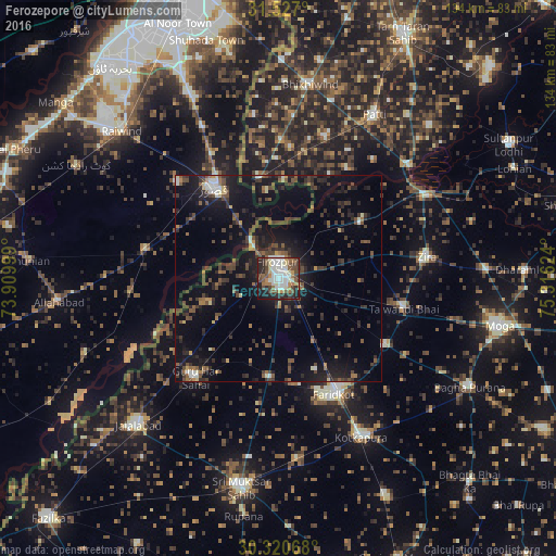
Analysis of Ferozepore night lights 2016
Square area 10x10 km:
 10.66%
90-99
19.06%80-89
5.59%70-79
4.37%60-69
6.99%50-59
8.74%40-49
11.89%30-39
5.94%20-29
16.78%10-19
9.62%0-9
0.35%Square area 50x50 km:
0.9%90-99
1.58%80-89
0.81%70-79
0.89%60-69
1.12%50-59
2.65%40-49
4.31%30-39
3.77%20-29
5.33%10-19
12.37%0-9
66.28%Clear (daylight) street map image can be seen on geolist.org.
Map coordinates:
31° 31' 37.2" North, 73° 54' 36" East
30° 55' 32.7" North, 74° 36' 47.2" East
30° 19' 14.4" North, 75° 18' 58.5" East
Some cities around Ferozepore sort by population:
• Kasur, PK
26.5 km =16.5 mi,  324°
324°
• Kotkapura
43.6 km =27.1 mi,  151°
151°
• Farīdkot
31.1 km =19.3 mi, 154°
• Zira
36.4 km =22.6 mi,  82°
82°
• Talwandi Bhai
31.2 km =19.4 mi,  104°
104°
• Guru Har Sahāi
31.3 km =19.4 mi,  219°
219°
• Makhu
41.5 km =25.8 mi,  61°
61°
• Khem Karan
24.8 km =15.4 mi,  348°
348°
1271883 (p: 102,130)
Sources (retrieved 2019-11-25):
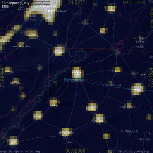
» NASA, Earths city lights 1995
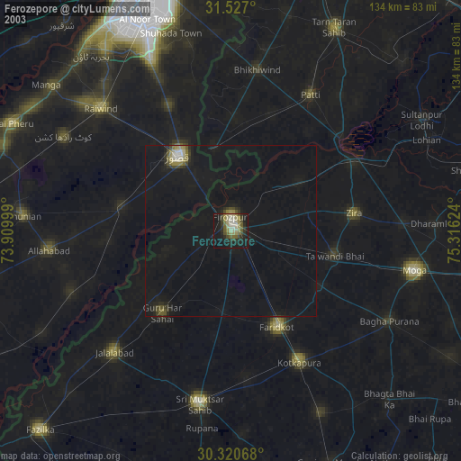
» NASA city lights 2003
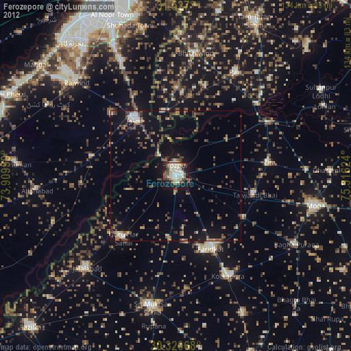
» Earth at Night: Flat Maps 2012, 2016