Kashmor night lights from space
Night Light of Kashmor (Sindh) from space (Pakistan) Src. Average luminocity for 10x10km area is 18.0397% and for 50x50km: 2.1365%.
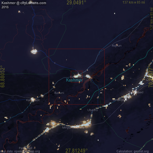
Analysis of Kashmor night lights 2016
Square area 10x10 km:
 2.18%
2.18%90-99
4.96%80-89
0.99%70-79
0.6%60-69
1.19%50-59
2.18%40-49
5.75%30-39
1.59%20-29
0.79%10-19
7.94%0-9
71.83%Square area 50x50 km:
0.26%90-99
0.41%80-89
0.12%70-79
0.12%60-69
0.34%50-59
0.24%40-49
0.49%30-39
0.35%20-29
0.15%10-19
0.51%0-9
97%Clear (daylight) street map image can be seen on geolist.org.
Map coordinates:
29° 2' 56.8" North, 68° 52' 49.9" East
28° 25' 57.4" North, 69° 35' 1.1" East
27° 48' 45" North, 70° 17' 12.4" East
Some cities around Kashmor sort by population:
• Saddiqabad
54.9 km =34.1 mi,  104°
104°
• Kandhkot
44.7 km =27.8 mi,  242°
242°
• Ghotki
54.4 km =33.8 mi,  208°
208°
• Mirpur Mathelo
45.9 km =28.5 mi,  184°
184°
• Khairpur
42.6 km =26.5 mi,  163°
163°
• Ghauspur
59 km =36.7 mi, 236°
• Ubauro
33.1 km =20.6 mi,  154°
154°
• Rojhan
45.9 km =28.5 mi,  51°
51°
1174653 (p: 33,732)
Sources (retrieved 2019-11-25):
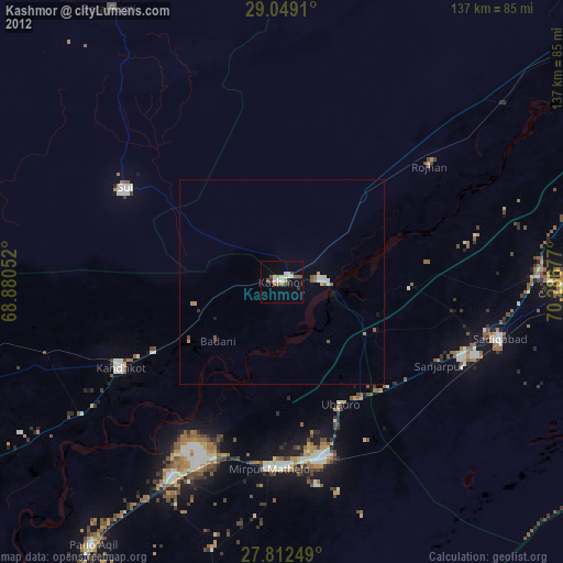
» Earth at Night: Flat Maps 2012, 2016