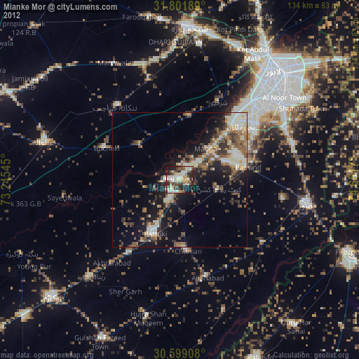
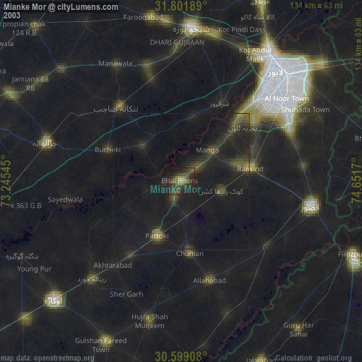
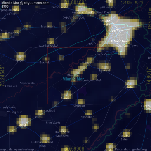
Mianke Mor night lights from space
Night Light of Mianke Mor (Punjab) from space (Pakistan) Src. Average luminocity for 10x10km area is 43.6648% and for 50x50km: 17.7401%.

Analysis of Mianke Mor night lights 2016
Square area 10x10 km:
 3.48%
3.48%90-99
8.97%80-89
3.85%70-79
6.23%60-69
4.58%50-59
5.49%40-49
14.65%30-39
9.71%20-29
20.7%10-19
19.23%0-9
3.11%Square area 50x50 km:
1.89%90-99
3.98%80-89
1.34%70-79
1.35%60-69
2.35%50-59
2.86%40-49
4.22%30-39
3.49%20-29
4.9%10-19
11.15%0-9
62.47%Clear (daylight) street map image can be seen on geolist.org.
Map coordinates:
31° 48' 6.8" North, 73° 14' 43.6" East
31° 12' 8.6" North, 73° 56' 54.9" East
30° 35' 56.7" North, 74° 39' 6.1" East
Some cities around Mianke Mor sort by population:
• Pattoki
22.2 km =13.8 mi,  204°
204°
• Chunian
26.4 km =16.4 mi,  173°
173°
• Nankana Sahib
35.9 km =22.3 mi,  320°
320°
• Kot Radha Kishan
14.9 km =9.3 mi,  103°
103°
• Sharqpur Sharif
32.2 km =20 mi,  26°
26°
• Raiwind
25.9 km =16.1 mi,  78°
78°
• Raja Jang
29.2 km =18.1 mi,  85°
85°
• Chak Five Hundred Seventy-five
39.8 km =24.7 mi,  343°
343°
1182829 (p: 86,900)
Sources (retrieved 2019-11-25):
» NASA, Earths city lights 1995
» NASA city lights 2003
» Earth at Night: Flat Maps 2012, 2016