Goth Radhan night lights from space
Night Light of Goth Radhan (Sindh) from space (Pakistan) Src. Average luminocity for 10x10km area is 6.2746% and for 50x50km: 1.9597%.
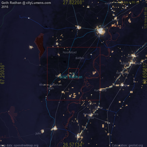
Analysis of Goth Radhan night lights 2016
Square area 10x10 km:
 0%
0%90-99
0.19%80-89
1.33%70-79
0%60-69
0%50-59
0%40-49
4.73%30-39
3.41%20-29
3.6%10-19
0%0-9
86.74%Square area 50x50 km:
0%90-99
0.04%80-89
0.16%70-79
0.3%60-69
0.68%50-59
0.25%40-49
0.73%30-39
0.55%20-29
0.26%10-19
0.29%0-9
96.75%Clear (daylight) street map image can be seen on geolist.org.
Map coordinates:
27° 49' 19.5" North, 67° 15' 1.3" East
27° 11' 54.5" North, 67° 57' 12.5" East
26° 34' 16.8" North, 68° 39' 23.8" East
Some cities around Goth Radhan sort by population:
• New Bādāh
17.7 km =11 mi,  25°
25°
• Mehar
13.3 km =8.3 mi,  261°
261°
• Khairpur Nathan Shah
24.7 km =15.3 mi,  241°
241°
• Nasirabad
20.7 km =12.9 mi,  349°
349°
• Sīta Road
21 km =13 mi,  209°
209°
• Kandiaro
29.8 km =18.5 mi,  121°
121°
• Warah
31.8 km =19.8 mi,  330°
330°
• Dokri
24.2 km =15 mi,  35°
35°
1167501 (p: 16,786)
Sources (retrieved 2019-11-25):
» Earth at Night: Flat Maps 2012, 2016