Sīta Road night lights from space
Night Light of Sīta Road (Sindh) from space (Pakistan) Src. Average luminocity for 10x10km area is 4.9187% and for 50x50km: 1.8522%.
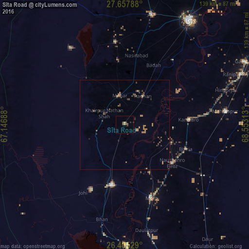
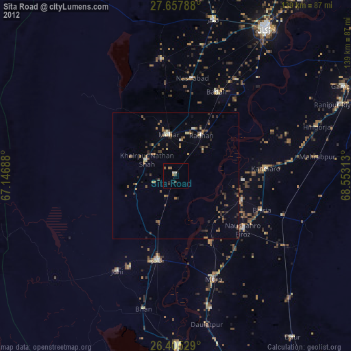
Analysis of Sīta Road night lights 2016
Square area 10x10 km:
 0%
0%90-99
0.2%80-89
0.6%70-79
0.79%60-69
0%50-59
1.59%40-49
2.78%30-39
1.59%20-29
0%10-19
0%0-9
92.46%Square area 50x50 km:
0%90-99
0.02%80-89
0.11%70-79
0.3%60-69
0.53%50-59
0.27%40-49
0.77%30-39
0.54%20-29
0.39%10-19
0.23%0-9
96.83%Clear (daylight) street map image can be seen on geolist.org.
Map coordinates:
27° 39' 28.4" North, 67° 8' 48.8" East
27° 1' 60" North, 67° 51' 0" East
26° 24' 19" North, 68° 33' 11.3" East
Some cities around Sīta Road sort by population:
• Dadu
34.5 km =21.4 mi,  192°
192°
• Mehar
16.6 km =10.3 mi,  349°
349°
• Khairpur Nathan Shah
13.1 km =8.1 mi,  299°
299°
• Kandiaro
35.8 km =22.2 mi,  85°
85°
• Tharu Shah
28.4 km =17.6 mi,  110°
110°
• Naushahro Firoz
34.5 km =21.4 mi,  128°
128°
• Goth Radhan
21 km =13 mi,  29°
29°
• Goth Phulji
23.7 km =14.7 mi,  224°
224°
1164716 (p: 27,587)
Sources (retrieved 2019-11-25):
» Earth at Night: Flat Maps 2012, 2016