Tuding night lights from space
Night Light of Tuding (Cordillera) from space (Philippines) Src. Average luminocity for 10x10km area is 35.8616% and for 50x50km: 3.9554%.
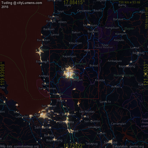
Analysis of Tuding night lights 2016
Square area 10x10 km:
 4.75%
4.75%90-99
3.93%80-89
7.23%70-79
12.4%60-69
2.89%50-59
2.48%40-49
4.13%30-39
2.48%20-29
9.3%10-19
19.83%0-9
30.58%Square area 50x50 km:
0.35%90-99
0.37%80-89
0.64%70-79
1.28%60-69
0.34%50-59
0.31%40-49
0.55%30-39
0.36%20-29
0.99%10-19
3.16%0-9
91.63%Clear (daylight) street map image can be seen on geolist.org.
Map coordinates:
17° 5' 2.9" North, 119° 56' 20.7" East
16° 24' 39.1" North, 120° 38' 31.9" East
15° 44' 6.8" North, 121° 20' 43.2" East
Some cities around Tuding sort by population:
• Baguio
5.3 km =3.3 mi,  276°
276°
• La Trinidad
7.6 km =4.7 mi,  310°
310°
• Aringay
30.7 km =19.1 mi,  266°
266°
• Itogon
6.4 km =4 mi,  144°
144°
• Sison
29.6 km =18.4 mi,  207°
207°
• Subusub
25.8 km =16 mi,  217°
217°
• Loacan
15.7 km =9.8 mi,  9°
9°
• Lloren
23.9 km =14.9 mi,  248°
248°
1681022 (p: 7,491)
Sources (retrieved 2019-11-25):
» Earth at Night: Flat Maps 2012, 2016