Tubod night lights from space
Night Light of Tubod (Northern Mindanao) from space (Philippines) Src. Average luminocity for 10x10km area is 5.3223% and for 50x50km: 1.4035%.
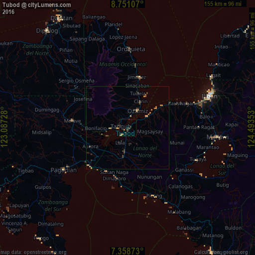
Analysis of Tubod night lights 2016
Square area 10x10 km:
 0%
0%90-99
0%80-89
0%70-79
2.48%60-69
0.83%50-59
0%40-49
1.65%30-39
1.65%20-29
2.89%10-19
0.83%0-9
89.67%Square area 50x50 km:
0%90-99
0%80-89
0.15%70-79
0.48%60-69
0.26%50-59
0.11%40-49
0.31%30-39
0.5%20-29
0.47%10-19
0.19%0-9
97.53%Clear (daylight) street map image can be seen on geolist.org.
Map coordinates:
8° 45' 3.9" North, 123° 5' 14.2" East
8° 3' 19.8" North, 123° 47' 25.4" East
7° 21' 31.4" North, 124° 29' 36.7" East
Some cities around Tubod sort by population:
• Ozamiz City
11.7 km =7.3 mi,  28°
28°
• Tangub
4.8 km =3 mi,  278°
278°
• Maranding
14.7 km =9.1 mi,  188°
188°
• Kapatagan
17.4 km =10.8 mi, 187°
• Lala
10.3 km =6.4 mi,  207°
207°
• Maigo
21.9 km =13.6 mi,  57°
57°
• Clarin
17.9 km =11.1 mi,  24°
24°
• Bacolod
15.5 km =9.6 mi, 63°
1681149 (p: 10,975)
Sources (retrieved 2019-11-25):
» Earth at Night: Flat Maps 2012, 2016