Ozamiz City night lights from space
Night Light of Ozamiz City (Northern Mindanao) from space (Philippines) Src. Average luminocity for 10x10km area is 4.9649% and for 50x50km: 1.3462%.
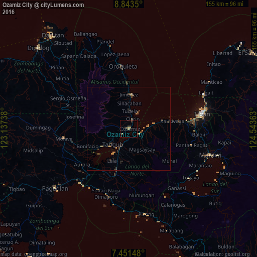
Analysis of Ozamiz City night lights 2016
Square area 10x10 km:
 0%
0%90-99
0%80-89
0%70-79
1.65%60-69
1.65%50-59
0%40-49
1.65%30-39
2.89%20-29
0.41%10-19
0%0-9
91.74%Square area 50x50 km:
0%90-99
0%80-89
0.07%70-79
0.46%60-69
0.29%50-59
0.14%40-49
0.3%30-39
0.52%20-29
0.41%10-19
0.19%0-9
97.6%Clear (daylight) street map image can be seen on geolist.org.
Map coordinates:
8° 50' 36.6" North, 123° 8' 14.6" East
8° 8' 53.2" North, 123° 50' 25.8" East
7° 27' 5.3" North, 124° 32' 37.1" East
Some cities around Ozamiz City sort by population:
• Tangub
14 km =8.7 mi,  226°
226°
• Maranding
26 km =16.2 mi,  197°
197°
• Tubod
11.7 km =7.3 mi,  208°
208°
• Lala
22 km =13.7 mi, 207°
• Maigo
13 km =8.1 mi,  83°
83°
• Clarin
6.3 km =3.9 mi,  17°
17°
• Jimenez
20.9 km =13 mi,  359°
359°
• Bacolod
9.1 km =5.7 mi,  112°
112°
1696899 (p: 93,082)
Sources (retrieved 2019-11-25):
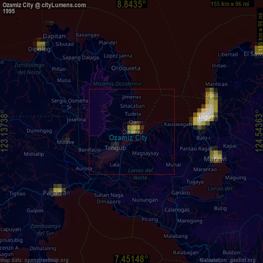
» NASA, Earths city lights 1995
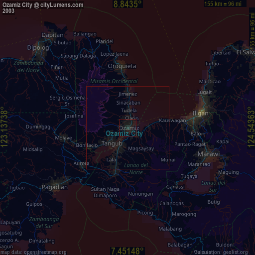
» NASA city lights 2003
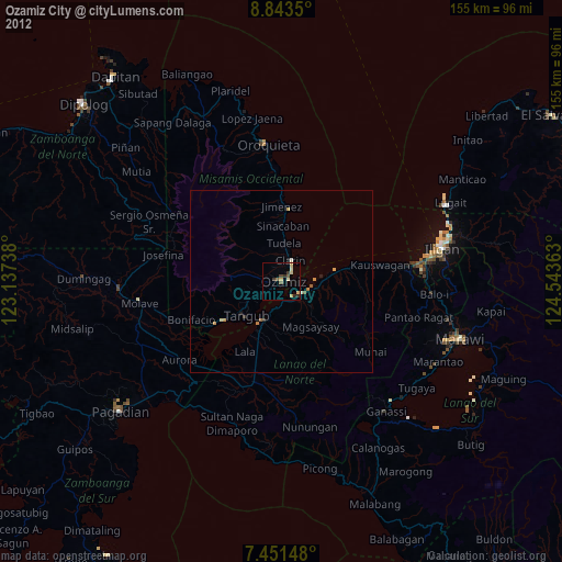
» Earth at Night: Flat Maps 2012, 2016