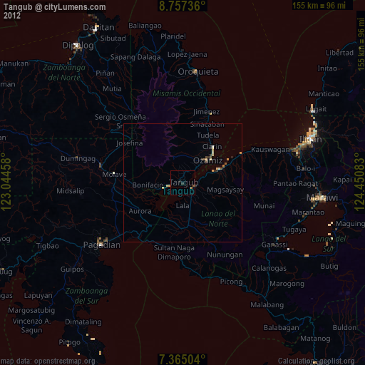
Tangub night lights from space
Night Light of Tangub (Northern Mindanao) from space (Philippines) Src. Average luminocity for 10x10km area is 4.9979% and for 50x50km: 1.3902%.
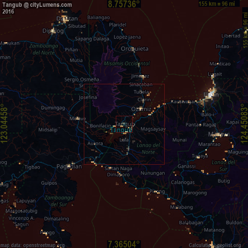
Analysis of Tangub night lights 2016
Square area 10x10 km:
 0%
0%90-99
0%80-89
0%70-79
3.1%60-69
0.21%50-59
0%40-49
1.24%30-39
0.83%20-29
2.89%10-19
0.41%0-9
91.32%Square area 50x50 km:
0%90-99
0%80-89
0.12%70-79
0.45%60-69
0.25%50-59
0.11%40-49
0.31%30-39
0.55%20-29
0.5%10-19
0.25%0-9
97.46%Clear (daylight) street map image can be seen on geolist.org.
Map coordinates:
8° 45' 26.5" North, 123° 2' 40.5" East
8° 3' 42.5" North, 123° 44' 51.7" East
7° 21' 54.1" North, 124° 27' 3" East
Some cities around Tangub sort by population:
• Ozamiz City
14 km =8.7 mi,  46°
46°
• Maranding
15.5 km =9.6 mi,  170°
170°
• Tubod
4.8 km =3 mi,  98°
98°
• Kapatagan
18.1 km =11.2 mi, 172°
• Lala
9.9 km =6.2 mi,  180°
180°
• Aurora
22 km =13.7 mi,  235°
235°
• Clarin
19.8 km =12.3 mi,  37°
37°
• Bacolod
19.6 km =12.2 mi,  71°
71°
1683116 (p: 29,721)
Sources (retrieved 2019-11-25):
» Earth at Night: Flat Maps 2012, 2016