Tayabas night lights from space
Night Light of Tayabas (Calabarzon) from space (Philippines) Src. Average luminocity for 10x10km area is 7.697% and for 50x50km: 3.9695%.
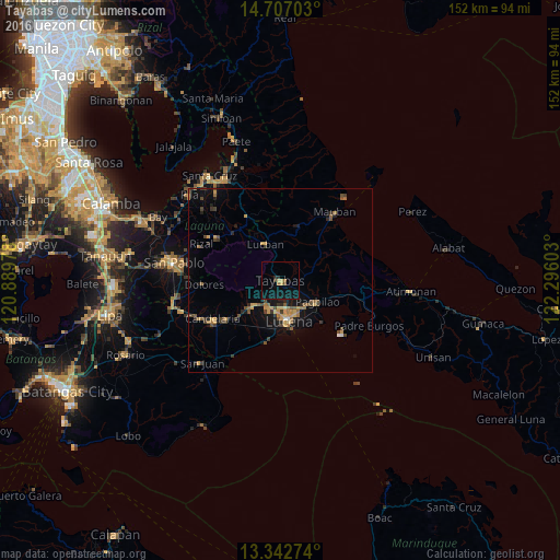
Analysis of Tayabas night lights 2016
Square area 10x10 km:
 0%
0%90-99
0%80-89
1.52%70-79
1.08%60-69
1.73%50-59
0%40-49
1.08%30-39
0.65%20-29
1.73%10-19
6.93%0-9
85.28%Square area 50x50 km:
0.09%90-99
0.04%80-89
0.3%70-79
1.09%60-69
0.66%50-59
0.63%40-49
0.98%30-39
0.74%20-29
0.76%10-19
2.6%0-9
92.1%Clear (daylight) street map image can be seen on geolist.org.
Map coordinates:
14° 42' 25.3" North, 120° 53' 23.2" East
14° 1' 33.2" North, 121° 35' 34.4" East
13° 20' 33.9" North, 122° 17' 45.7" East
Some cities around Tayabas sort by population:
• Lucena
10.8 km =6.7 mi,  165°
165°
• Sariaya
10.1 km =6.3 mi,  225°
225°
• Pagbilao
13.1 km =8.1 mi,  119°
119°
• Lucban
10.5 km =6.5 mi,  337°
337°
• Castañas
17.4 km =10.8 mi,  194°
194°
• Mamala
8.3 km =5.2 mi,  262°
262°
• Sampaloc
16 km =9.9 mi,  18°
18°
• Janagdong
16.1 km =10 mi,  212°
212°
1682659 (p: 37,330)
Sources (retrieved 2019-11-25):
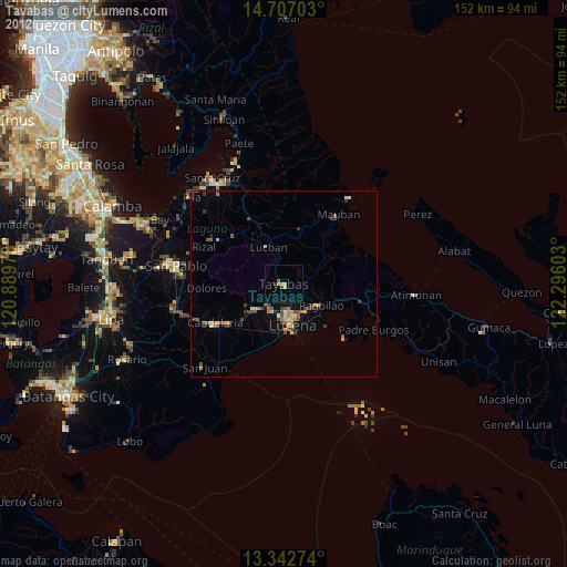
» Earth at Night: Flat Maps 2012, 2016