Sariaya night lights from space
Night Light of Sariaya (Calabarzon) from space (Philippines) Src. Average luminocity for 10x10km area is 13.0475% and for 50x50km: 4.9462%.
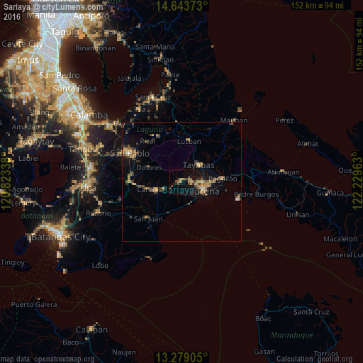
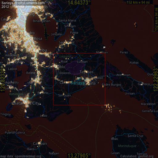
Analysis of Sariaya night lights 2016
Square area 10x10 km:
 0%
0%90-99
0%80-89
0%70-79
5.37%60-69
1.03%50-59
2.89%40-49
4.13%30-39
1.03%20-29
1.65%10-19
11.36%0-9
72.52%Square area 50x50 km:
0.1%90-99
0.07%80-89
0.43%70-79
1.34%60-69
0.94%50-59
0.87%40-49
1.03%30-39
1.05%20-29
0.81%10-19
3.33%0-9
90.02%Clear (daylight) street map image can be seen on geolist.org.
Map coordinates:
14° 38' 37.4" North, 120° 49' 24.2" East
13° 57' 44.6" North, 121° 31' 35.4" East
13° 16' 44.6" North, 122° 13' 46.7" East
Some cities around Sariaya sort by population:
• Lucena
10.4 km =6.5 mi,  109°
109°
• Tayabas
10.1 km =6.3 mi,  45°
45°
• Concepcion Ibaba
8.3 km =5.2 mi,  238°
238°
• Malabanban Norte
10.5 km =6.5 mi,  259°
259°
• Castañas
10.2 km =6.3 mi,  163°
163°
• Mamala
6.1 km =3.8 mi,  350°
350°
• Guisguis
9.9 km =6.2 mi,  184°
184°
• Janagdong
6.7 km =4.2 mi,  192°
192°
1687164 (p: 44,977)
Sources (retrieved 2019-11-25):
» Earth at Night: Flat Maps 2012, 2016