Pagbilao night lights from space
Night Light of Pagbilao (Calabarzon) from space (Philippines) Src. Average luminocity for 10x10km area is 6.4401% and for 50x50km: 2.7898%.
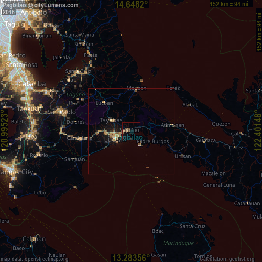

Analysis of Pagbilao night lights 2016
Square area 10x10 km:
 0%
0%90-99
0%80-89
0.83%70-79
0%60-69
0.83%50-59
3.1%40-49
2.48%30-39
1.03%20-29
0%10-19
2.69%0-9
89.05%Square area 50x50 km:
0.09%90-99
0.04%80-89
0.29%70-79
0.83%60-69
0.45%50-59
0.43%40-49
0.62%30-39
0.4%20-29
0.52%10-19
2.22%0-9
94.11%Clear (daylight) street map image can be seen on geolist.org.
Map coordinates:
14° 38' 53.5" North, 120° 59' 42.8" East
13° 58' 0.8" North, 121° 41' 54.1" East
13° 17' 0.8" North, 122° 24' 5.3" East
Some cities around Pagbilao sort by population:
• Lucena
9.6 km =6 mi,  245°
245°
• Sariaya
18.5 km =11.5 mi,  268°
268°
• Tayabas
13.1 km =8.1 mi,  299°
299°
• Castañas
18.7 km =11.6 mi,  236°
236°
• Malinao Ilaya
15.2 km =9.4 mi,  77°
77°
• Mamala
20.4 km =12.7 mi,  285°
285°
• Malicboy
9.9 km =6.2 mi, 80°
• Janagdong
21.2 km =13.2 mi, 250°
1696614 (p: 40,818)
Sources (retrieved 2019-11-25):
» Earth at Night: Flat Maps 2012, 2016