Tanauan night lights from space
Night Light of Tanauan (Eastern Visayas) from space (Philippines) Src. Average luminocity for 10x10km area is 4.2987% and for 50x50km: 2.2169%.
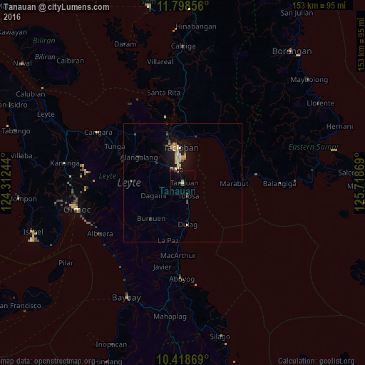
Analysis of Tanauan night lights 2016
Square area 10x10 km:
 0%
0%90-99
0%80-89
0.87%70-79
0%60-69
0.87%50-59
0.87%40-49
1.3%30-39
0.87%20-29
0%10-19
0.65%0-9
94.59%Square area 50x50 km:
0.08%90-99
0.08%80-89
0.61%70-79
0.46%60-69
0.26%50-59
0.15%40-49
0.35%30-39
0.26%20-29
0.31%10-19
2.06%0-9
95.36%Clear (daylight) street map image can be seen on geolist.org.
Map coordinates:
11° 47' 54.8" North, 124° 18' 44.8" East
11° 6' 34" North, 125° 0' 56" East
10° 25' 7.3" North, 125° 43' 7.3" East
Some cities around Tanauan sort by population:
• Tacloban
14.9 km =9.3 mi,  355°
355°
• Panalanoy
15.8 km =9.8 mi, 356°
• Palo
6 km =3.7 mi,  333°
333°
• Burauen
20 km =12.4 mi,  221°
221°
• Dulag
17.5 km =10.9 mi,  174°
174°
• Alangalang
21.3 km =13.2 mi,  300°
300°
• Jaro
26.7 km =16.6 mi,  288°
288°
• Basey
20.1 km =12.5 mi,  17°
17°
1683342 (p: 16,567)
Sources (retrieved 2019-11-25):
» Earth at Night: Flat Maps 2012, 2016