Taal night lights from space
Night Light of Taal (Calabarzon) from space (Philippines) Src. Average luminocity for 10x10km area is 12.407% and for 50x50km: 9.7841%.
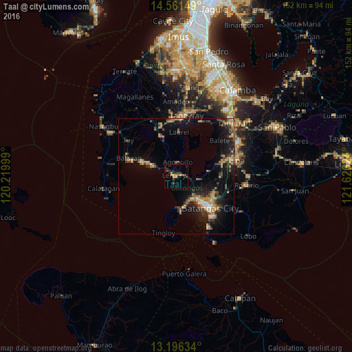
Analysis of Taal night lights 2016
Square area 10x10 km:
 0%
0%90-99
0%80-89
0.41%70-79
4.34%60-69
1.03%50-59
1.45%40-49
3.51%30-39
3.51%20-29
4.96%10-19
5.58%0-9
75.21%Square area 50x50 km:
0.45%90-99
0.58%80-89
0.5%70-79
2.61%60-69
1.97%50-59
0.91%40-49
2.04%30-39
1.92%20-29
2.45%10-19
8.47%0-9
78.1%Clear (daylight) street map image can be seen on geolist.org.
Map coordinates:
14° 33' 41.4" North, 120° 13' 12" East
13° 52' 47.7" North, 120° 55' 23.2" East
13° 11' 46.8" North, 121° 37' 34.5" East
Some cities around Taal sort by population:
• San Pascual
13.2 km =8.2 mi,  125°
125°
• Calaca
13.2 km =8.2 mi,  296°
296°
• Bauan
13.5 km =8.4 mi,  136°
136°
• Cuenca
14.1 km =8.8 mi,  79°
79°
• Santa Rita Aplaya
17 km =10.6 mi, 134°
• Subic
7.9 km =4.9 mi,  13°
13°
• Bolo
11.8 km =7.3 mi,  147°
147°
• Taysan
18.8 km =11.7 mi,  93°
93°
1685146 (p: 39,745)
Sources (retrieved 2019-11-25):
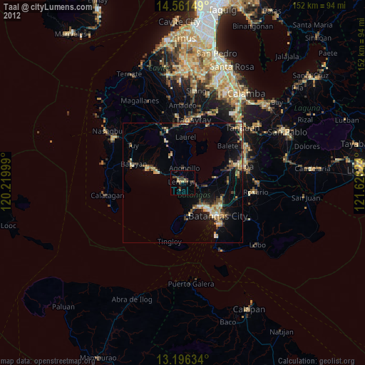
» Earth at Night: Flat Maps 2012, 2016