Subic night lights from space
Night Light of Subic (Calabarzon) from space (Philippines) Src. Average luminocity for 10x10km area is 2.407% and for 50x50km: 13.598%.
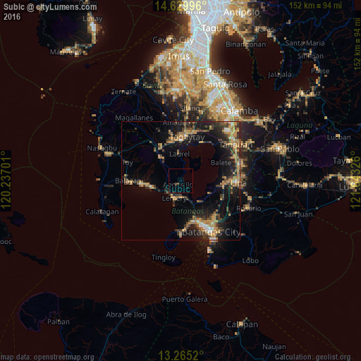
Analysis of Subic night lights 2016
Square area 10x10 km:
 0%
0%90-99
0%80-89
0%70-79
0%60-69
0%50-59
0%40-49
1.65%30-39
0%20-29
1.24%10-19
2.48%0-9
94.63%Square area 50x50 km:
0.63%90-99
0.73%80-89
0.82%70-79
3.99%60-69
2.93%50-59
1.36%40-49
3.07%30-39
2.68%20-29
3.47%10-19
10.91%0-9
69.41%Clear (daylight) street map image can be seen on geolist.org.
Map coordinates:
14° 37' 47.9" North, 120° 14' 13.2" East
13° 56' 54.9" North, 120° 56' 24.5" East
13° 15' 54.7" North, 121° 38' 35.7" East
Some cities around Subic sort by population:
• Tagaytay
16.3 km =10.1 mi,  357°
357°
• Taal
7.9 km =4.9 mi,  193°
193°
• San Pascual
17.7 km =11 mi,  150°
150°
• Calaca
13.8 km =8.6 mi,  262°
262°
• Talisay
18.3 km =11.4 mi,  28°
28°
• Cuenca
13.1 km =8.1 mi,  113°
113°
• Laurel
12.1 km =7.5 mi,  349°
349°
• Bolo
18.2 km =11.3 mi,  165°
165°
1685578 (p: 8,881)
Sources (retrieved 2019-11-25):
» Earth at Night: Flat Maps 2012, 2016