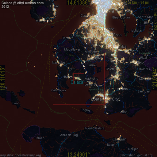
Calaca night lights from space
Night Light of Calaca (Calabarzon) from space (Philippines) Src. Average luminocity for 10x10km area is 16.0248% and for 50x50km: 6.7836%.

Analysis of Calaca night lights 2016
Square area 10x10 km:
 0.83%
0.83%90-99
0.83%80-89
1.03%70-79
5.17%60-69
2.89%50-59
3.31%40-49
0%30-39
3.31%20-29
1.86%10-19
5.17%0-9
75.62%Square area 50x50 km:
0.23%90-99
0.25%80-89
0.31%70-79
1.6%60-69
1.57%50-59
0.93%40-49
1.46%30-39
1.6%20-29
1.48%10-19
5.46%0-9
85.09%Clear (daylight) street map image can be seen on geolist.org.
Map coordinates:
14° 36' 49.9" North, 120° 6' 36.5" East
13° 55' 56.8" North, 120° 48' 47.8" East
13° 14' 56.4" North, 121° 30' 59" East
Some cities around Calaca sort by population:
• Balayan
8.8 km =5.5 mi,  273°
273°
• Taal
13.2 km =8.2 mi,  116°
116°
• Laurel
17.8 km =11.1 mi,  39°
39°
• Subic
13.8 km =8.6 mi,  82°
82°
• Tuy
13.1 km =8.1 mi,  316°
316°
• Binubusan
19.6 km =12.2 mi,  282°
282°
• Putol
11.4 km =7.1 mi,  305°
305°
• Aga
18.3 km =11.4 mi,  356°
356°
1720751 (p: 37,443)
Sources (retrieved 2019-11-25):
» Earth at Night: Flat Maps 2012, 2016