Sibul night lights from space
Night Light of Sibul (Central Luzon) from space (Philippines) Src. Average luminocity for 10x10km area is 0% and for 50x50km: 2.3625%.
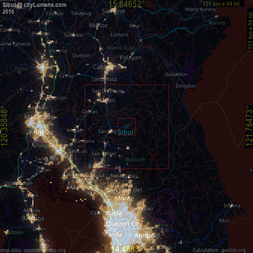
Analysis of Sibul night lights 2016
Square area 10x10 km:
 0%
0%90-99
0%80-89
0%70-79
0%60-69
0%50-59
0%40-49
0%30-39
0%20-29
0%10-19
0%0-9
100%Square area 50x50 km:
0.01%90-99
0.02%80-89
0.09%70-79
0.5%60-69
0.58%50-59
0.22%40-49
0.63%30-39
0.76%20-29
0.85%10-19
1.46%0-9
94.87%Clear (daylight) street map image can be seen on geolist.org.
Map coordinates:
15° 50' 47.5" North, 120° 21' 30.5" East
15° 10' 8.4" North, 121° 3' 41.8" East
14° 29' 21.5" North, 121° 45' 53" East
Some cities around Sibul sort by population:
• Gapan
19.7 km =12.2 mi,  321°
321°
• San Ildefonso
16.2 km =10.1 mi,  232°
232°
• San Miguel
9.7 km =6 mi,  252°
252°
• General Tinio
20.3 km =12.6 mi,  355°
355°
• Pulo
16.7 km =10.4 mi,  300°
300°
• Camias
9.4 km =5.8 mi,  268°
268°
• Salapungan
14.9 km =9.3 mi, 254°
• Tartaro
4.8 km =3 mi, 266°
1686737 (p: 8,225)
Sources (retrieved 2019-11-25):
» Earth at Night: Flat Maps 2012, 2016