San Miguel night lights from space
Night Light of San Miguel (Central Luzon) from space (Philippines) Src. Average luminocity for 10x10km area is 3.6178% and for 50x50km: 4.3504%.
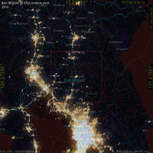
Analysis of San Miguel night lights 2016
Square area 10x10 km:
 0%
0%90-99
0%80-89
0.62%70-79
0.83%60-69
1.03%50-59
0.83%40-49
0%30-39
0.83%20-29
2.27%10-19
0.21%0-9
93.39%Square area 50x50 km:
0.01%90-99
0.02%80-89
0.16%70-79
0.88%60-69
0.9%50-59
0.56%40-49
1.12%30-39
1.46%20-29
1.61%10-19
4.14%0-9
89.13%Clear (daylight) street map image can be seen on geolist.org.
Map coordinates:
15° 49' 11.7" North, 120° 16' 21.2" East
15° 8' 32.3" North, 120° 58' 32.4" East
14° 27' 45" North, 121° 40' 43.7" East
Some cities around San Miguel sort by population:
• San Ildefonso
7.8 km =4.8 mi,  208°
208°
• Candaba
16.8 km =10.4 mi,  252°
252°
• Pulo
12.6 km =7.8 mi,  336°
336°
• Bahay Pare
15.9 km =9.9 mi,  219°
219°
• Sibul
9.7 km =6 mi,  72°
72°
• Camias
2.7 km =1.7 mi,  356°
356°
• Salapungan
5.2 km =3.2 mi,  259°
259°
• Tartaro
5.2 km =3.2 mi,  58°
58°
1688954 (p: 65,661)
Sources (retrieved 2019-11-25):
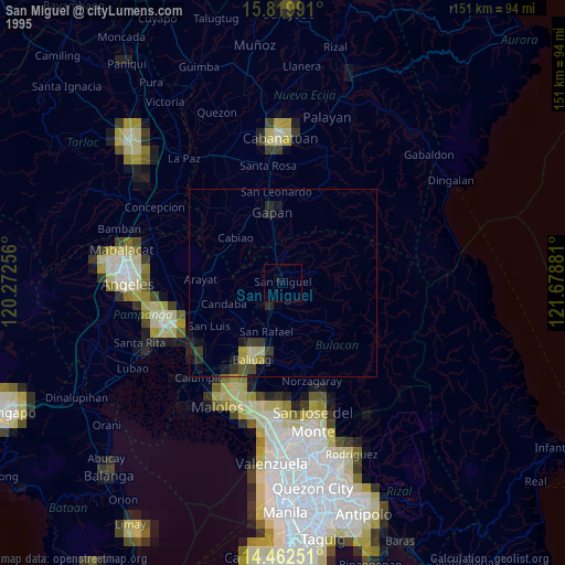
» NASA, Earths city lights 1995
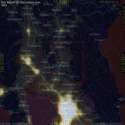
» NASA city lights 2003
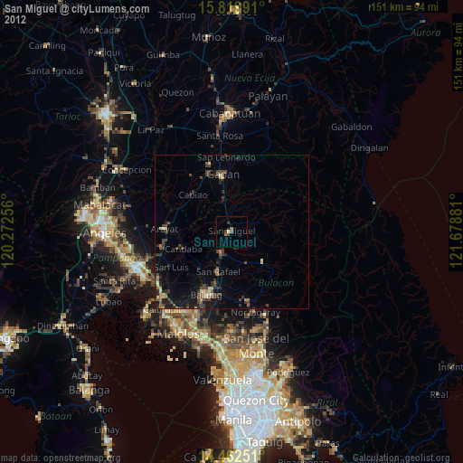
» Earth at Night: Flat Maps 2012, 2016