San Isidro night lights from space
Night Light of San Isidro (Central Visayas) from space (Philippines) Src. Average luminocity for 10x10km area is 0.2727% and for 50x50km: 0.3985%.
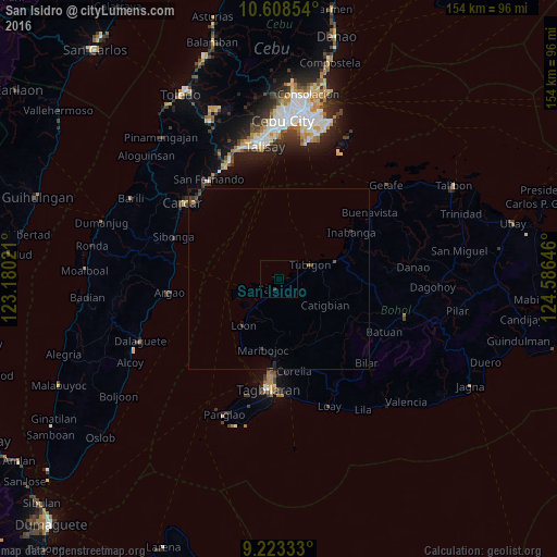
Analysis of San Isidro night lights 2016
Square area 10x10 km:
 0%
0%90-99
0%80-89
0%70-79
0%60-69
0%50-59
0%40-49
0%30-39
0.62%20-29
0.21%10-19
0%0-9
99.17%Square area 50x50 km:
0%90-99
0%80-89
0%70-79
0%60-69
0.06%50-59
0.05%40-49
0.16%30-39
0.24%20-29
0.23%10-19
0.1%0-9
99.16%Clear (daylight) street map image can be seen on geolist.org.
Map coordinates:
10° 36' 30.7" North, 123° 10' 48.8" East
9° 55' 0" North, 123° 52' 60" East
9° 13' 24" North, 124° 35' 11.3" East
Some cities around San Isidro sort by population:
• Tagbilaran City
29.2 km =18.1 mi,  186°
186°
• San Fernando
33.4 km =20.8 mi,  324°
324°
• Ocaña
32.8 km =20.4 mi,  300°
300°
• Sibonga
31.2 km =19.4 mi,  290°
290°
• Tibigan
9.5 km =5.9 mi,  65°
65°
• Perrelos
32 km =19.9 mi,  314°
314°
• Loon
16.3 km =10.1 mi,  217°
217°
• Argao
31.8 km =19.8 mi,  262°
262°
1689787 (p: 9,125)
Sources (retrieved 2019-11-25):
» Earth at Night: Flat Maps 2012, 2016