Tagbilaran City night lights from space
Night Light of Tagbilaran City (Central Visayas) from space (Philippines) Src. Average luminocity for 10x10km area is 24.9719% and for 50x50km: 1.3888%.
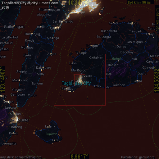
Analysis of Tagbilaran City night lights 2016
Square area 10x10 km:
 1.52%
1.52%90-99
1.08%80-89
2.6%70-79
3.03%60-69
9.09%50-59
3.9%40-49
6.28%30-39
4.11%20-29
5.41%10-19
11.69%0-9
51.3%Square area 50x50 km:
0.06%90-99
0.04%80-89
0.17%70-79
0.12%60-69
0.42%50-59
0.15%40-49
0.33%30-39
0.38%20-29
0.36%10-19
0.55%0-9
97.42%Clear (daylight) street map image can be seen on geolist.org.
Map coordinates:
10° 20' 52.8" North, 123° 8' 56.7" East
9° 39' 20" North, 123° 51' 7.9" East
8° 57' 42.1" North, 124° 33' 19.2" East
Some cities around Tagbilaran City sort by population:
• Danao
15.4 km =9.6 mi,  222°
222°
• Loboc
20.1 km =12.5 mi,  95°
95°
• Tibigan
35.1 km =21.8 mi,  20°
20°
• Loon
17.3 km =10.7 mi,  337°
337°
• San Isidro
29.2 km =18.1 mi,  6°
6°
• Dalaguete
36.7 km =22.8 mi,  288°
288°
• Panglao
14.5 km =9 mi,  233°
233°
• Argao
37.6 km =23.4 mi,  311°
311°
1684497 (p: 86,411)
Sources (retrieved 2019-11-25):
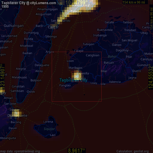
» NASA, Earths city lights 1995
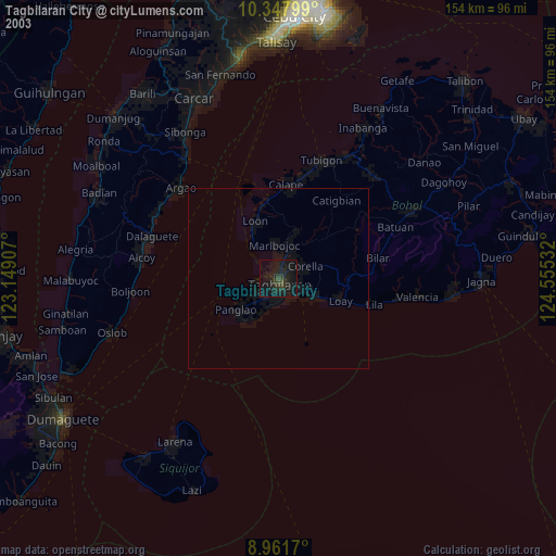
» NASA city lights 2003
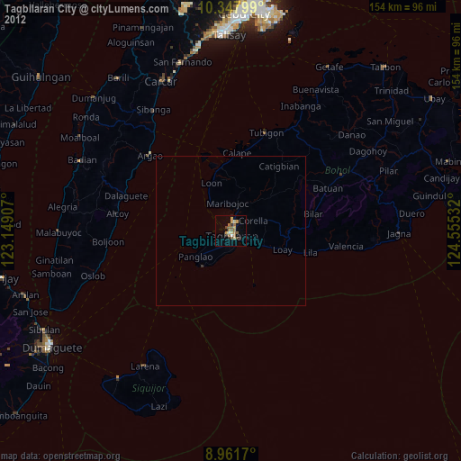
» Earth at Night: Flat Maps 2012, 2016