President Roxas night lights from space
Night Light of President Roxas (Soccsksargen) from space (Philippines) Src. Average luminocity for 10x10km area is 0.1818% and for 50x50km: 1.6623%.
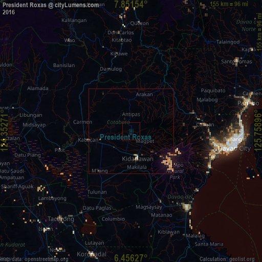
Analysis of President Roxas night lights 2016
Square area 10x10 km:
 0%
0%90-99
0%80-89
0%70-79
0%60-69
0%50-59
0%40-49
0%30-39
0%20-29
0%10-19
0.87%0-9
99.13%Square area 50x50 km:
0.04%90-99
0.04%80-89
0.25%70-79
0.62%60-69
0.44%50-59
0.1%40-49
0.03%30-39
0.27%20-29
0.1%10-19
1.3%0-9
96.8%Clear (daylight) street map image can be seen on geolist.org.
Map coordinates:
7° 51' 5.5" North, 124° 21' 9.8" East
7° 9' 16" North, 125° 3' 21" East
6° 27' 22.6" North, 125° 45' 32.3" East
Some cities around President Roxas sort by population:
• Kidapawan
16.7 km =10.4 mi,  167°
167°
• Kabacan
25.6 km =15.9 mi,  258°
258°
• Makilala
23 km =14.3 mi, 168°
• Matalam
18.7 km =11.6 mi,  246°
246°
• Amas
13.4 km =8.3 mi,  216°
216°
• Malasila
24.8 km =15.4 mi,  160°
160°
• Magpet
8.9 km =5.5 mi,  132°
132°
• Saguing
19.5 km =12.1 mi, 172°
1692781 (p: 10,879)
Sources (retrieved 2019-11-25):
» Earth at Night: Flat Maps 2012, 2016