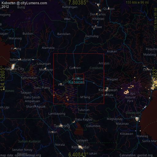
Kabacan night lights from space
Night Light of Kabacan (Soccsksargen) from space (Philippines) Src. Average luminocity for 10x10km area is 1.1472% and for 50x50km: 0.2905%.
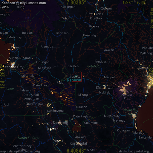
Analysis of Kabacan night lights 2016
Square area 10x10 km:
 0%
0%90-99
0%80-89
0%70-79
0%60-69
0.22%50-59
0.65%40-49
0%30-39
0.87%20-29
0.87%10-19
0%0-9
97.4%Square area 50x50 km:
0%90-99
0%80-89
0%70-79
0.17%60-69
0.04%50-59
0.1%40-49
0%30-39
0.07%20-29
0.03%10-19
0.07%0-9
99.52%Clear (daylight) street map image can be seen on geolist.org.
Map coordinates:
7° 48' 13.9" North, 124° 7' 33.8" East
7° 6' 24" North, 124° 49' 45" East
6° 24' 30.3" North, 125° 31' 56.3" East
Some cities around Kabacan sort by population:
• Pikit
18.3 km =11.4 mi,  251°
251°
• President Roxas
25.6 km =15.9 mi,  78°
78°
• Matalam
8.2 km =5.1 mi,  105°
105°
• Carmen
11.6 km =7.2 mi,  339°
339°
• Bialong
15.5 km =9.6 mi,  154°
154°
• Bagontapay
28.9 km =18 mi,  162°
162°
• Amas
17.9 km =11.1 mi, 107°
• Pagalungan
15.2 km =9.4 mi, 248°
1710011 (p: 31,769)
Sources (retrieved 2019-11-25):
» Earth at Night: Flat Maps 2012, 2016