Kidapawan night lights from space
Night Light of Kidapawan (Soccsksargen) from space (Philippines) Src. Average luminocity for 10x10km area is 7.3074% and for 50x50km: 2.0855%.
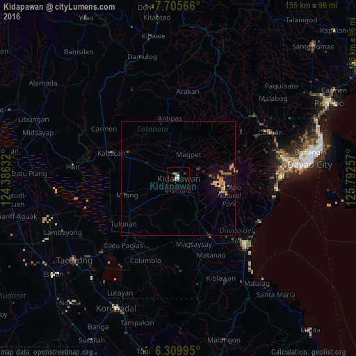
Analysis of Kidapawan night lights 2016
Square area 10x10 km:
 1.08%
1.08%90-99
0.65%80-89
1.73%70-79
0.43%60-69
1.3%50-59
0.87%40-49
0.65%30-39
2.81%20-29
0%10-19
0%0-9
90.48%Square area 50x50 km:
0.04%90-99
0.04%80-89
0.34%70-79
0.78%60-69
0.53%50-59
0.1%40-49
0.03%30-39
0.26%20-29
0.07%10-19
1.83%0-9
95.98%Clear (daylight) street map image can be seen on geolist.org.
Map coordinates:
7° 42' 20.4" North, 124° 23' 10.8" East
7° 0' 30" North, 125° 5' 22" East
6° 18' 35.8" North, 125° 47' 33.3" East
Some cities around Kidapawan sort by population:
• Makilala
6.4 km =4 mi,  172°
172°
• President Roxas
16.7 km =10.4 mi,  347°
347°
• Matalam
22.6 km =14 mi,  292°
292°
• Bialong
22.3 km =13.9 mi,  262°
262°
• Amas
12.8 km =8 mi, 294°
• Malasila
8.4 km =5.2 mi,  148°
148°
• Magpet
10.6 km =6.6 mi,  15°
15°
• Saguing
3.4 km =2.1 mi,  201°
201°
1708824 (p: 79,652)
Sources (retrieved 2019-11-25):
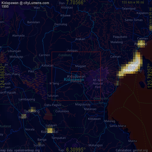
» NASA, Earths city lights 1995
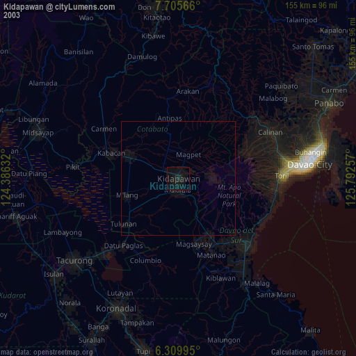
» NASA city lights 2003
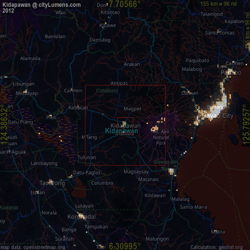
» Earth at Night: Flat Maps 2012, 2016